Your Guide to Current Conditions at Snowbird
Get the latest, real-time updates on conditions at Snowbird. Our guide covers Little Cottonwood Canyon road status, traction laws, weather, and resort operations to help you plan your trip.
Understanding the current conditions at Snowbird is critical for a safe and enjoyable day on the mountain. This involves checking the Little Cottonwood Canyon road status, traction laws, weather forecast, avalanche danger, and resort operations before you leave. This guide centralizes all that live data, providing actionable tips so you can spend less time guessing and more time skiing.
What Conditions Should I Check at Snowbird?
Before you head up Little Cottonwood Canyon, a quick check of a few key metrics can be the difference between a great day and a frustrating one. These are the non-negotiables for assessing the conditions at Snowbird.
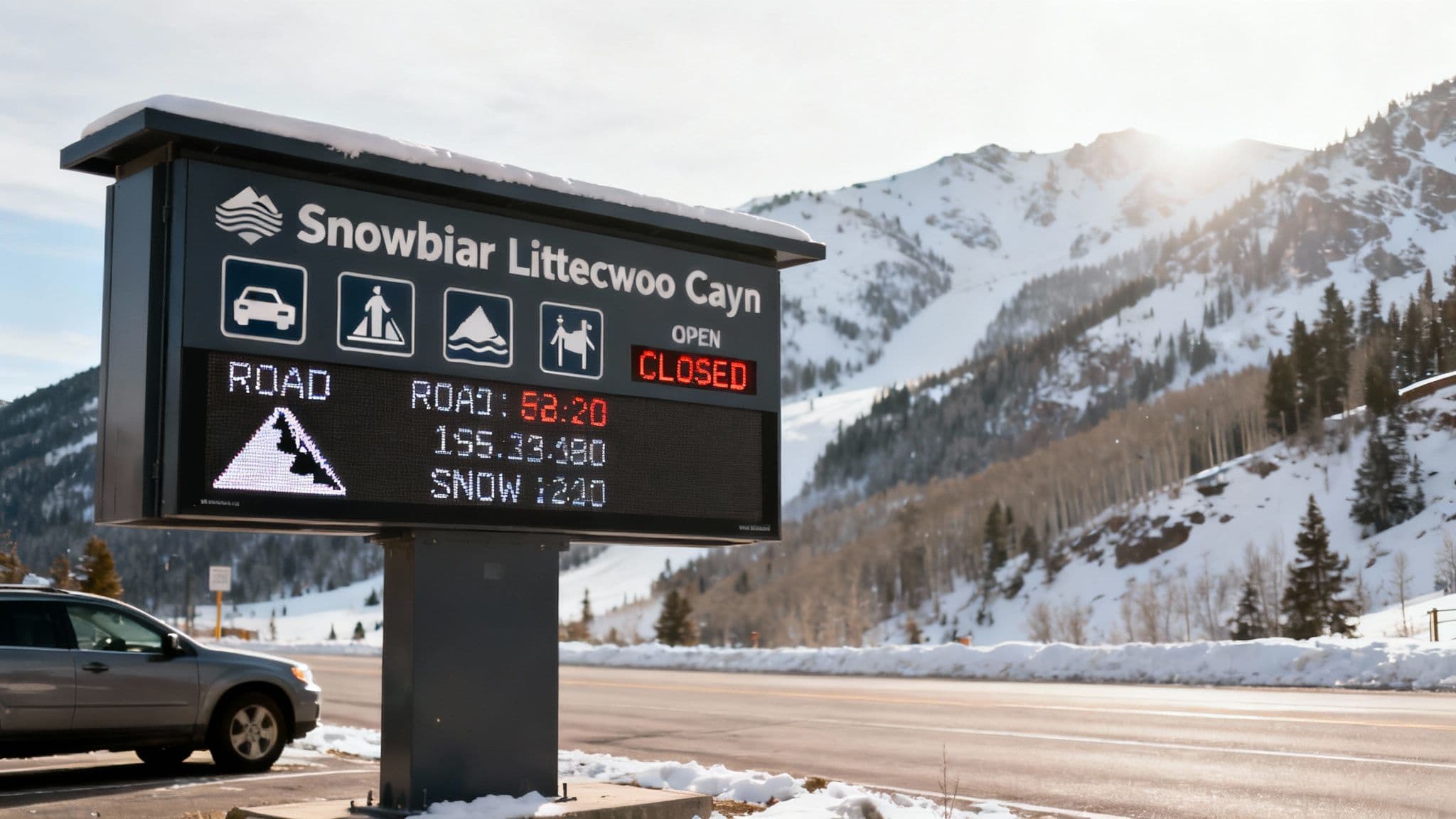
Your At-a-Glance Snowbird Conditions Checklist
This table summarizes the most critical information you need. Use it as a pre-flight checklist before making the "go or no-go" decision.
| Condition Type | Current Status | Where to Check Live Data |
|---|---|---|
| LCC Road Status | Open, Restricted, or Closed | Wasatch Roads LCC Dashboard |
| Traction Law | Active or Inactive (4WD/Chains) | Wasatch Roads LCC Dashboard |
| Avalanche Forecast | Low to Extreme Danger Rating | Utah Avalanche Center |
| Recent Snowfall | 24-Hour & 48-Hour Totals | Snowbird Mountain Report |
| Resort Operations | Lifts Open/On Hold, Terrain Status | Snowbird Mountain Report |
A quick scan of this data tells you everything from road rules to what kind of powder to expect.
Key Data Points Explained
- LCC Road Status: Is the road open, restricted for certain vehicles, or shut down completely for avalanche control? This is the first thing to check.
- Traction Law: Is UDOT requiring 4WD/AWD with proper tires or chains? Don't get turned around or cause an accident because you weren't prepared.
- Avalanche Forecast: What's the current danger rating from the pros at the Utah Avalanche Center? This tells you about the stability of the snowpack, which impacts both resort and backcountry safety.
- Recent Snowfall: How much fresh snow has fallen in the last 24 to 48 hours? This is your powder-day intel.
- Resort Operations: Which lifts are spinning? Is any terrain on a wind hold? Knowing this manages expectations before you even get there.
By getting all this information in one spot, you can quickly size up the situation. You'll know if it's a good day to head up, what the drive will be like, and how the skiing is shaping up. A proactive check saves you from getting stuck in the "red snake" or showing up totally unprepared for the conditions.
When and How to Check Snowbird Conditions
Timing your checks and knowing where to find reliable information is crucial. Here's how to navigate road status, weather reports, and on-mountain operations like a local.
How to Navigate the Little Cottonwood Canyon Road
The drive up Little Cottonwood Canyon to Snowbird is legendary, but it's a road that demands respect. Before you head up, your first move should be to check the official road report from the Utah Department of Transportation (UDOT). This is a dynamic mountain environment where the road can go from dry pavement to a blizzard in the blink of an eye.
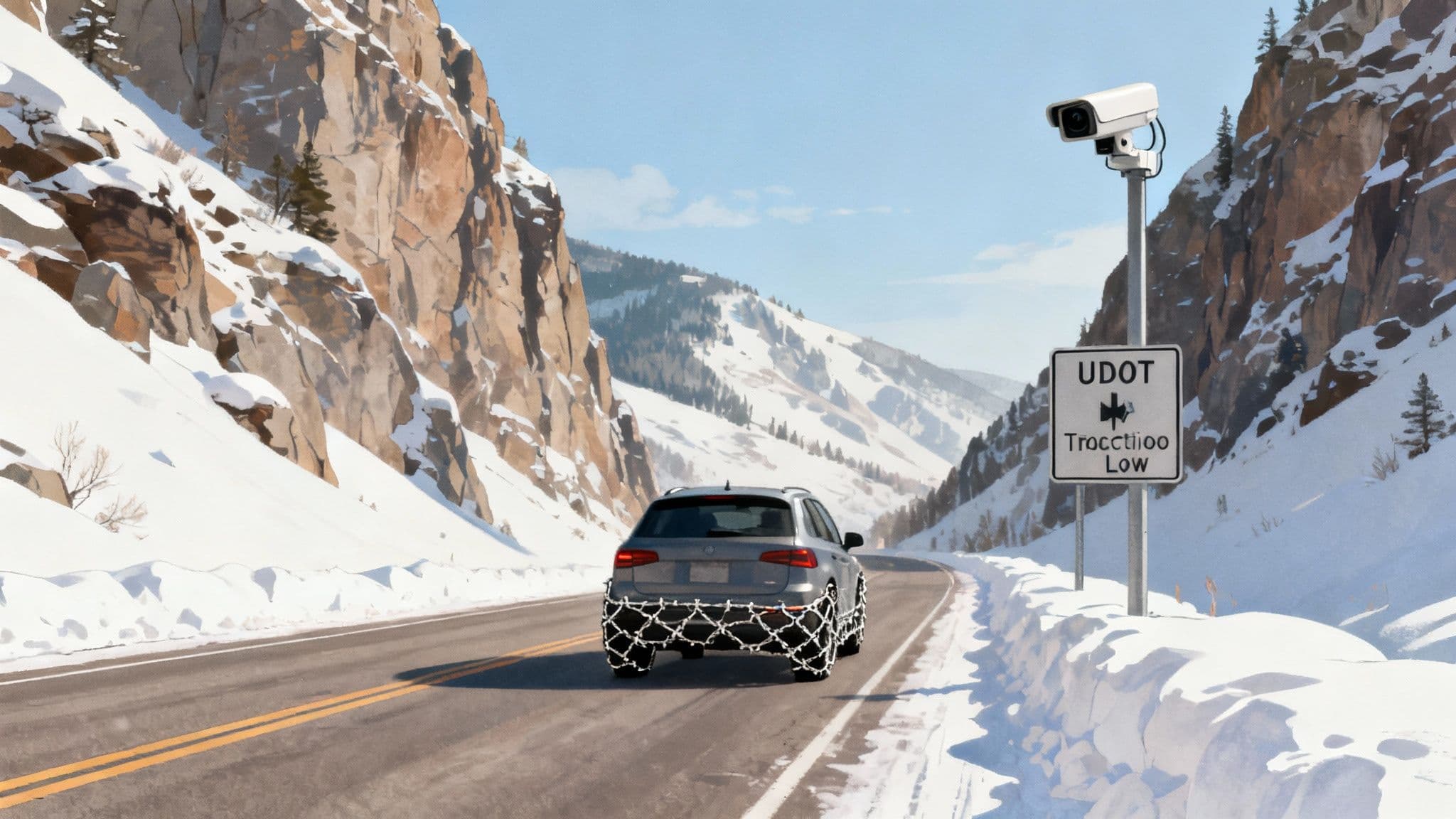
Decoding the Traction Law
When you see "Traction Law in Effect," take it seriously. It means UDOT is requiring specific gear for every vehicle entering the canyon.
- 4WD/AWD Vehicles: Must be equipped with snow tires (look for M+S, M/S, or the three-peak mountain snowflake symbol, also known as 3PMSF).
- 2WD Vehicles: You must have snow tires and carry chains or other traction devices. Be prepared to pull over and put them on if conditions get dicey.
Local Tip: A single car spinning out can close the road for hours. Following the traction law means you’re part of the solution, not the problem that creates the infamous "red snake" of brake lights.
Understanding Canyon Closures
When Little Cottonwood Canyon closes, it's almost always for avalanche mitigation or accidents. These closures often happen in the early morning after a big storm. If you're staying at the resort, you might hear the term interlodge, which is when all outside travel is prohibited while this work happens. For a live, complete picture, our dedicated page for Little Cottonwood Canyon conditions pulls all the UDOT data and camera feeds into one place.
Actionable Tips for a Smoother Drive
- Go Early or Late: Peak traffic is 7:00 AM to 10:00 AM uphill and 3:00 PM to 6:00 PM downhill. Try to hit the mouth of the canyon before 7:30 AM or wait until after 10:30 AM.
- Check the Cameras: Don't just read the report—see it for yourself. Our Little Cottonwood Canyon cameras show you real-time pavement conditions and traffic.
- Consider the Bus: The UTA Ski Bus is a local's secret weapon. It eliminates the stress of driving and parking, dropping you right at the plaza.
How to Understand Snowbird Weather and Snowfall
The weather in Little Cottonwood Canyon is famous for its lake effect snow, which produces the light, dry powder Snowbird is known for. But it also brings high winds and rapid changes. Your phone's weather app won't cut it; you need to read the mountain's unique language.
How to Read the Snow Report Like a Local
- 24-Hour and 48-Hour Snow Totals: Anything over 6 inches in 24 hours promises a fantastic day. If you see 12+ inches, you're looking at an all-time deep powder day.
- Snow Water Equivalent (SWE): This is the pro metric. A low SWE ratio (like 15:1) means you're getting that classic, feather-light Wasatch powder.
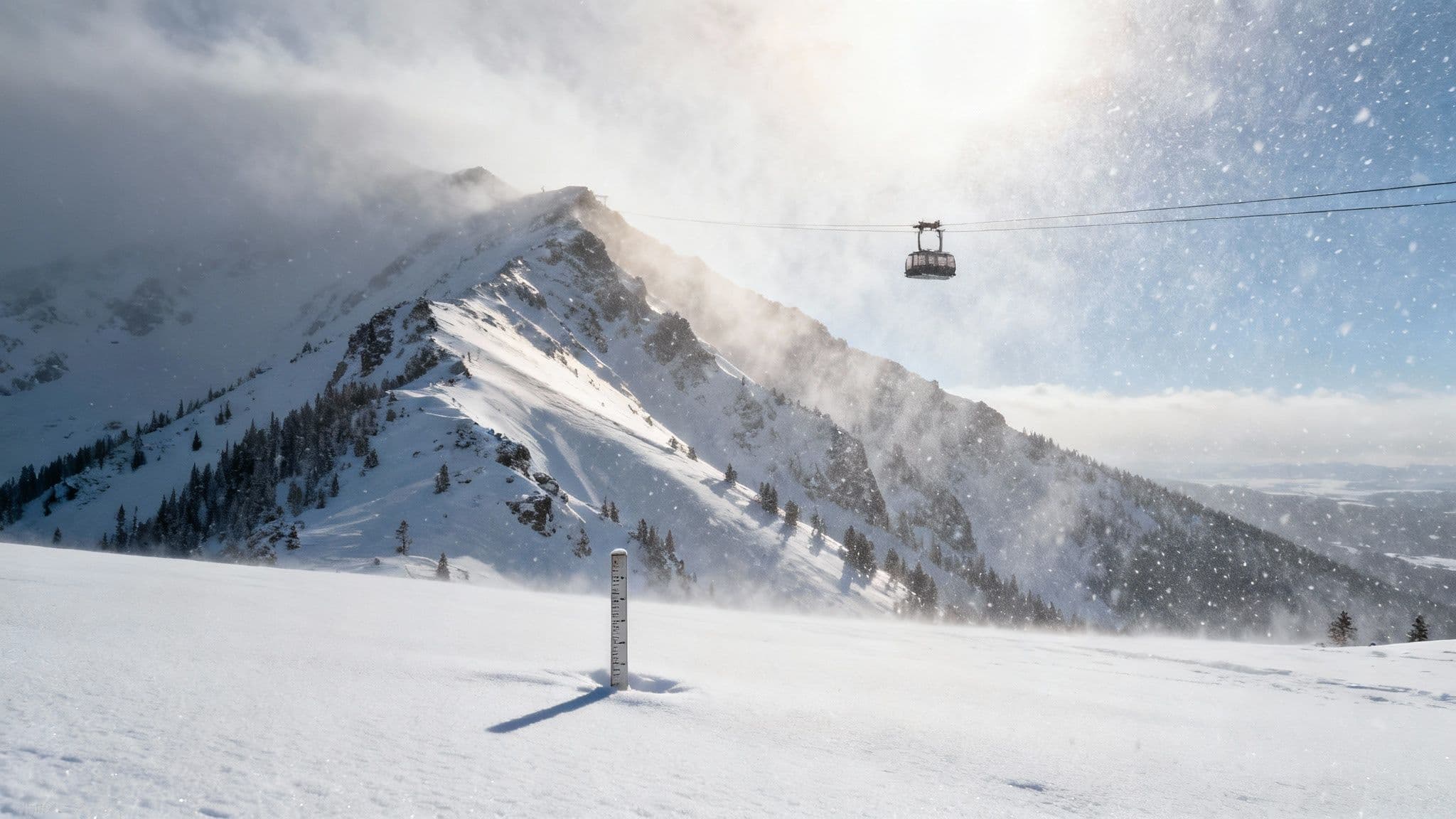
- Wind Speed and Direction: Check readings for both the base and summit. Sustained winds at the top of the tram over 40 mph are a red flag for potential lift holds and scoured ridges.
Snowbird averages a staggering 427 inches of snow a year, with many seasons blowing past the 500-inch mark. You can explore Snowbird's impressive snowfall history over on OnTheSnow.com.
Actionable Tips for Any Forecast
- Layer Up: Dress in non-negotiable layers: a moisture-wicking base, an insulating mid-layer, and a waterproof/windproof shell.
- Pack for the Worst: Always bring goggles for low visibility, a neck gaiter for windburn, and your warmest gloves. Weather can change dramatically between the base and the summit.
How to Check On-Mountain Operations
Once you're at the resort, knowing which lifts are spinning and what terrain is open is the key to a great day. The resort's official app and mountain report are your best resources for real-time updates.
How to Interpret the Daily Mountain Report
- Lift Status: Check what’s running, what’s on hold, and what’s scheduled for a delayed opening. A delayed opening for a lift like Mineral Basin Express after a storm often means patrol is finishing avalanche control, and it will be incredible when it opens.
- Grooming Report: This is your treasure map for finding fresh corduroy. Head straight for these trails first thing.
- Parking Status: On weekends and powder days, parking is a competitive sport. Snowbird often uses a reservation system. Check their website beforehand to book a spot or know the carpooling incentives. Don't forget the Big Cottonwood Canyon ski bus guide; many tips apply here.
Snowbird's terrain covers 2,500 skiable acres with a vertical drop of 3,240 feet. With its connection to Alta, the playground expands to 4,700 acres. You can dive into the resort's amazing history over at Utah Guide.
How to Read the Avalanche Forecast
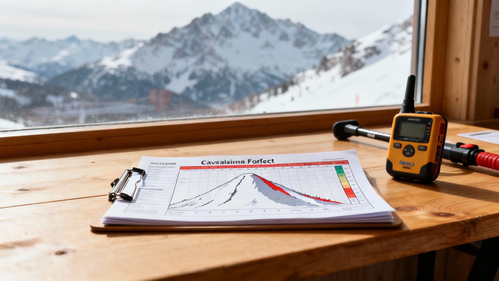
Safety is everything in Little Cottonwood Canyon, and it starts with the snowpack. Making the daily forecast from the Utah Avalanche Center (UAC) part of your morning routine is non-negotiable.
Understanding the Danger Scale
The UAC uses a five-level scale. A jump from "Moderate" (Level 2) to "Considerable" (Level 3) isn't just one step up; it’s a huge increase in risk that signals a much more reactive snowpack.
- Level 1 Low: Generally stable snow.
- Level 2 Moderate: Human-triggered avalanches are possible.
- Level 3 Considerable: Human-triggered avalanches are likely.
- Level 4 High: Natural and human-triggered avalanches are very likely.
- Level 5 Extreme: Avoid all avalanche terrain.
Local Tip: Even on a "Low" danger day, the risk is never zero. The UAC forecast is primarily for unmitigated backcountry terrain. Inside Snowbird's boundaries, ski patrol performs extensive avalanche control to make in-bounds terrain significantly safer. You can learn more in our detailed snow report for Snowbird, Utah.
FAQs about Snowbird Conditions
Here are quick answers to the questions we hear most often.
When Is the Traction Law Enforced?
The traction law is enforced anytime conditions are snowy or icy, typically from fall through spring. UDOT makes the call based on the forecast. Assume it might be in effect for any winter trip and check the live status on our Little Cottonwood Canyon page before you drive.
What Does a Wind Hold Mean?
A "wind hold" is a temporary lift closure due to high winds, which is common for upper mountain lifts like the Aerial Tram. The resort pauses operations until gusts die down. Check the resort’s app for real-time lift status, as these holds can be brief or last for hours.
How Do I Know If the Road Is Closed?
The most reliable, up-to-the-minute news on road closures comes from the official UDOT Traffic app and their social media. Closures are a regular part of life here, usually happening in the early morning for avalanche control or due to accidents. Always check before you start driving.
Stop guessing and start knowing. Wasatch Roads pulls all the live data you need—from road status and UDOT cameras to weather and resort operations—into one simple, clear dashboard. Plan smarter and travel safer with us at https://wasatchroads.com.