Your Guide to Little Cottonwood Canyon Road Conditions
Get real-time updates and expert tips on Little Cottonwood Canyon road conditions. Learn how to check the status, understand closures, and drive safely to Alta and Snowbird.
Checking Little Cottonwood Canyon road conditions is the most critical step for a safe and successful trip to Alta or Snowbird. State Route 210 is notoriously unpredictable due to steep terrain, intense snowfall, and high avalanche risk, causing conditions to change in minutes. This guide explains what you need to know, when to check for updates, and how to use live data to avoid getting stuck in traffic.
What is the current road status for Little Cottonwood Canyon?
Your trip to Alta or Snowbird begins at home with a quick check of the official sources for State Route 210. The Utah Department of Transportation (UDOT) provides the most reliable, up-to-the-minute information on road status, traction laws, and closures.
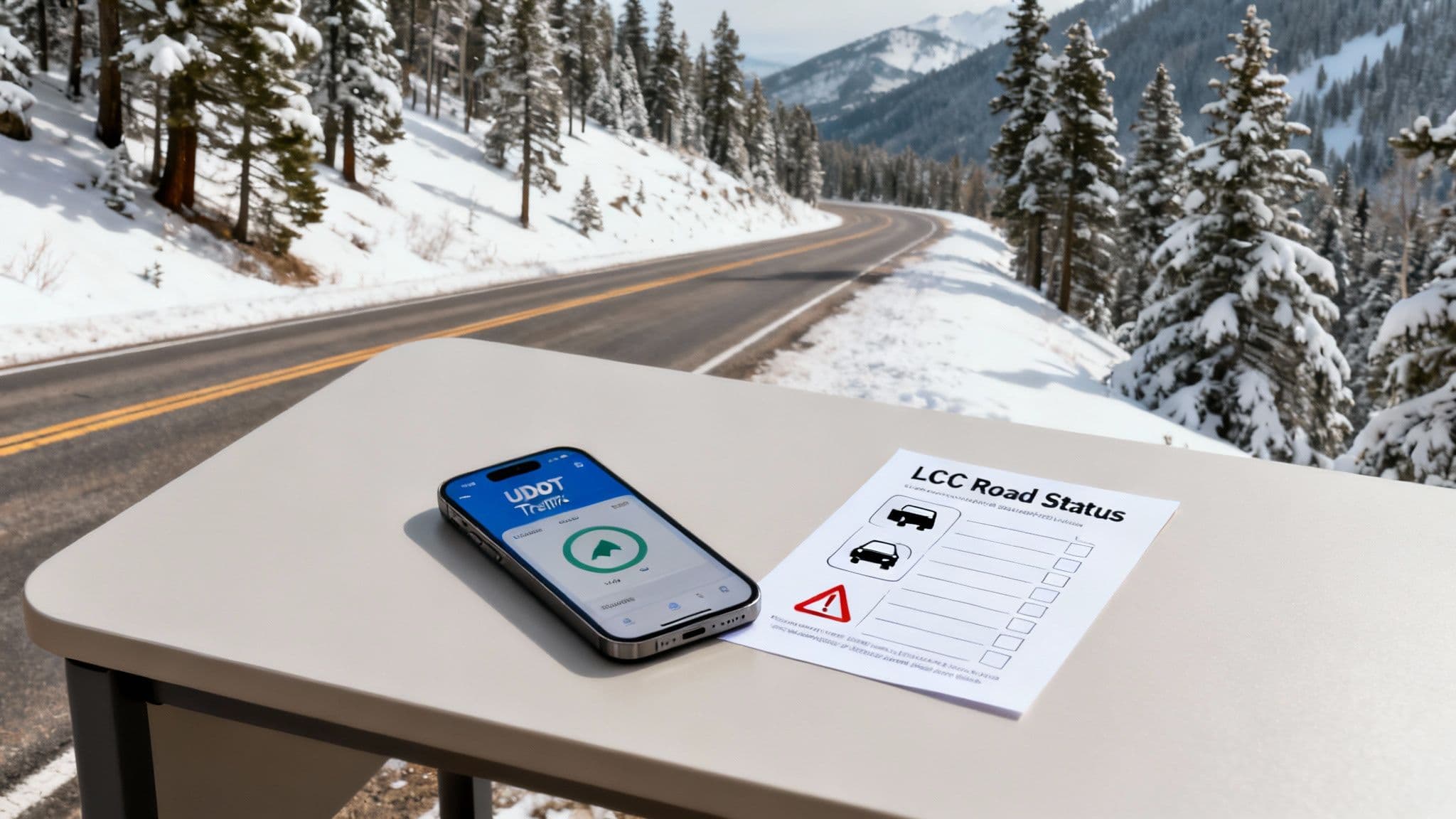
This screenshot from UDOT’s page shows exactly what to look for: a clear status for both uphill and downhill travel, plus any active traction law requirements. While a green "Open" sign is your goal, a yellow or red status demands your attention, as it signals traction device requirements or an imminent closure.
To see the situation for yourself, you can view the live Little Cottonwood Canyon cameras on our site for a real-world look at traffic and road surfaces.
Essential Resources for LCC Road Conditions
Here are the best places to get fast, reliable information for your trip up SR-210.
| Resource | What It Provides | Best For |
|---|---|---|
| UDOT Cottonwood Canyons Website | Official road status (Open/Closed), traction law, incident alerts | The most reliable, at-a-glance status before you leave. |
| @UDOTCottonwoods on X (Twitter) | Up-to-the-minute alerts on closures, avalanche control, and accidents | Real-time, play-by-play updates directly from crews on the road. |
| Wasatch Roads LCC Cameras | Live video feeds of key points along SR-210 | Visually checking traffic flow, road surface, and current weather. |
| UDOT Traffic App | Live traffic map, camera feeds, and push notifications | An all-in-one tool for checking conditions while on the move. |
When do LCC road conditions change?
Conditions on State Route 210 can change from clear to closed in minutes. This volatility is driven by three main factors: extreme geography, intense weather, and a high volume of traffic all converging in a narrow space.
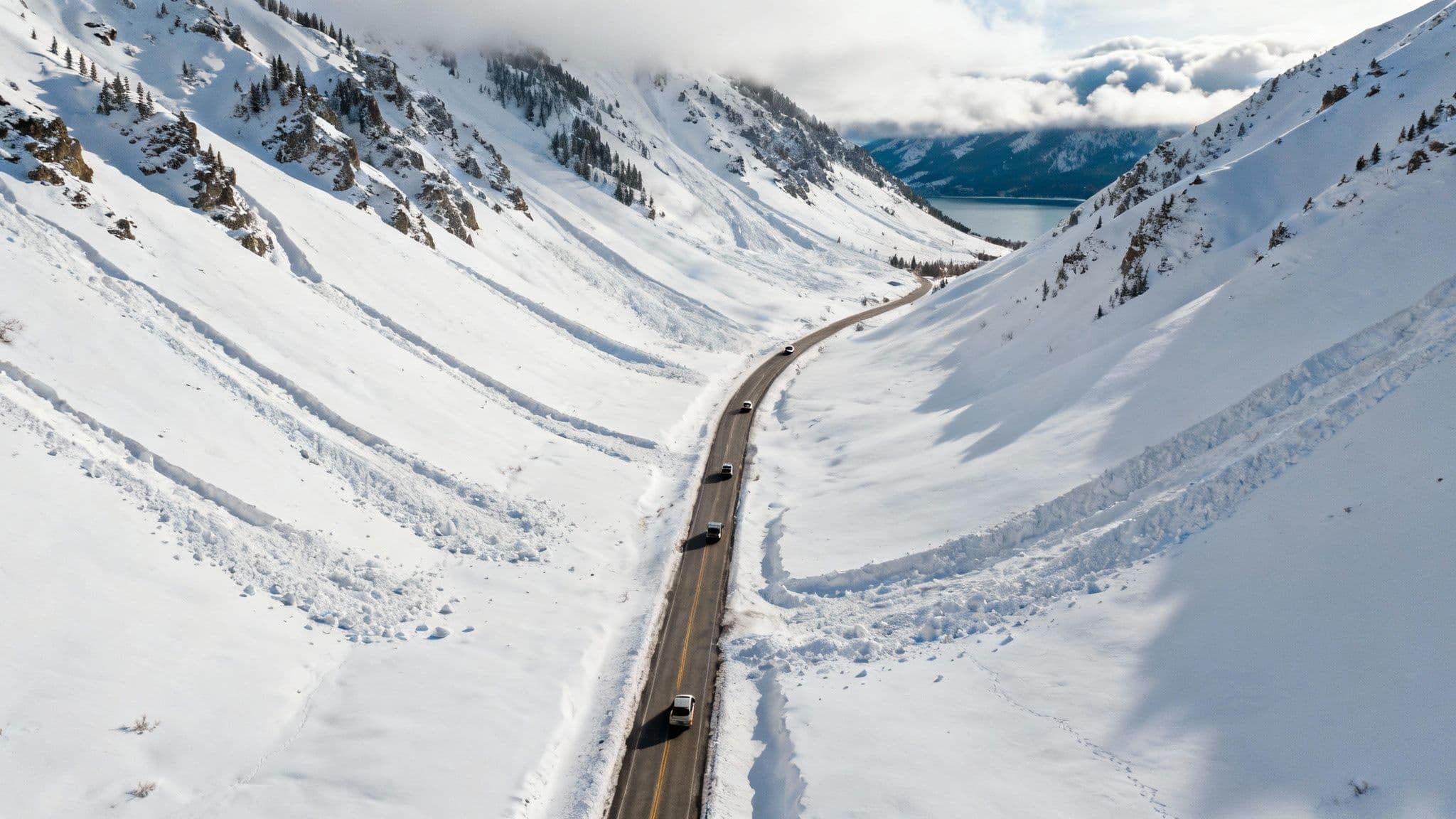
Steep Terrain and High Avalanche Risk
The canyon's steep walls create a natural funnel for avalanches, with 58 known slide paths crossing the road. This constant threat forces UDOT to conduct frequent avalanche mitigation work, often closing the road with little warning to trigger controlled slides and prevent a larger natural disaster.
Intense Lake-Effect Snowfall
Little Cottonwood Canyon is a magnet for "lake-effect" snow, which can produce snowfall rates of 2-4 inches per hour. This intense weather quickly overwhelms plows, reduces visibility, and creates treacherous driving conditions, often leading to traction law implementation or full closures for safety.
Sheer Volume of Traffic
The final factor is the massive number of vehicles. With 78% of skiers driving their own cars, the narrow two-lane road quickly becomes overwhelmed. A single accident can cause a complete standstill, backing up traffic for miles in what locals call the "Red Snake." You can learn more about how traffic impacts canyon safety at Save Our Canyons.
How to check Little Cottonwood Canyon road conditions and prepare
Knowing where to find Little Cottonwood Canyon road conditions is the first step; understanding how to interpret them is the key to a successful trip. This means looking beyond a simple "open" or "closed" status to make smarter travel decisions.
Decode UDOT Alerts and Statuses
When you check the road status, you will encounter specific alerts. These are official directives based on real-time dangers, and understanding them is crucial for a safe journey.
| Alert Status | What It Means | Your Action Plan |
|---|---|---|
| Chains/4WD Required | This is the state's Traction Law. The road is slick, and you're legally required to have proper equipment. | For 2WD cars, you must have chains on your tires. For 4WD/AWD, you need tires with an M+S or 3PMSF rating. |
| Road Closed for Avalanche Control | A planned closure where UDOT crews use explosives to bring down small, controlled avalanches. | Expect delays. This often happens early in the morning on big powder days. Stay put and wait for the "all clear." |
| Interlodge | The most serious alert. Avalanche danger is so high that it is illegal to go outside. | You are locked down. Whether at a resort or in the town of Alta, you cannot leave the building until officials lift the order. |
Combine Road Reports with Avalanche Forecasts
For the most complete picture, layer the road report with the daily avalanche forecast from the Utah Avalanche Center (UAC). If the UAC reports high or extreme avalanche danger and UDOT reports heavy snow, the probability of a road closure for avalanche control is very high. This insight allows you to adjust your plan, such as leaving earlier, taking the UTA Ski Bus, or choosing another day.
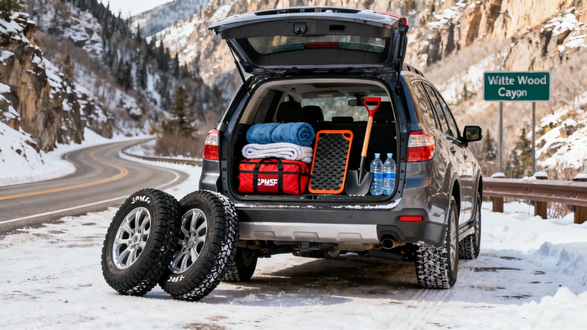
Prepare Your Vehicle for Winter Driving
Driving in LCC requires preparation. Before you leave, ensure your vehicle is ready for winter conditions.
- Master Utah's Traction Law: For 4WD/AWD vehicles, ensure your tires have the M+S (Mud and Snow) or, preferably, the 3-Peak Mountain Snowflake (3PMSF) symbol. For 2WD vehicles, you are required to have chains on your drive tires when the law is in effect.
- Be Ready for Delays: Never enter the canyon with less than half a tank of gas. Road closures can last for hours, and you’ll need fuel to stay warm. Pack an emergency kit with blankets, water, snacks, and a shovel.
- Drive Defensively: The steep grades and tight curves demand 100% of your attention. Leave at least 8-10 seconds of following distance, and brake and accelerate gently to maintain traction.
Understand the Impact on Local Neighborhoods
When SR-210 closes, gridlock spills into the communities at the canyon's mouth, blocking residential streets and delaying emergency responders. This affects thousands of Salt Lake County residents. Choosing to carpool, use the ski bus, or travel during off-peak hours helps reduce the strain on this fragile system. You can explore the data behind these issues in the feasibility study of these impacts and learn more in our complete Little Cottonwood Canyon traffic guide.
Frequently Asked Questions
When is the best time to drive up LCC to avoid traffic?
To avoid the heaviest traffic, travel uphill before 7:00 AM or after 10:00 AM. For the downhill trip, leave the resort before 2:30 PM or wait until after 6:00 PM. The peak congestion times are typically 7:00 AM–9:30 AM for uphill traffic and 3:00 PM–5:30 PM for downhill.
Do I really need snow tires in Little Cottonwood Canyon?
Yes. While M+S (all-season) tires are the legal minimum for 4WD/AWD vehicles during a Traction Law, dedicated winter tires with the 3-Peak Mountain Snowflake (3PMSF) symbol provide significantly better grip and stopping power on steep, icy canyon roads. They are the safer choice.
Why is the road closed if it looks clear on the cameras?
A road closure is often for avalanche mitigation work occurring on the slopes high above the road, not on the road surface itself. Crews may be using explosives to clear unstable snow. Always trust the official UDOT status over what you see on a camera.
For the most comprehensive, up-to-the-minute picture of canyon conditions, trust Wasatch Roads. Our platform consolidates live cameras, traffic data, and official UDOT alerts to help you make the smartest travel decisions. Get a clear view before you go at wasatchroads.com.