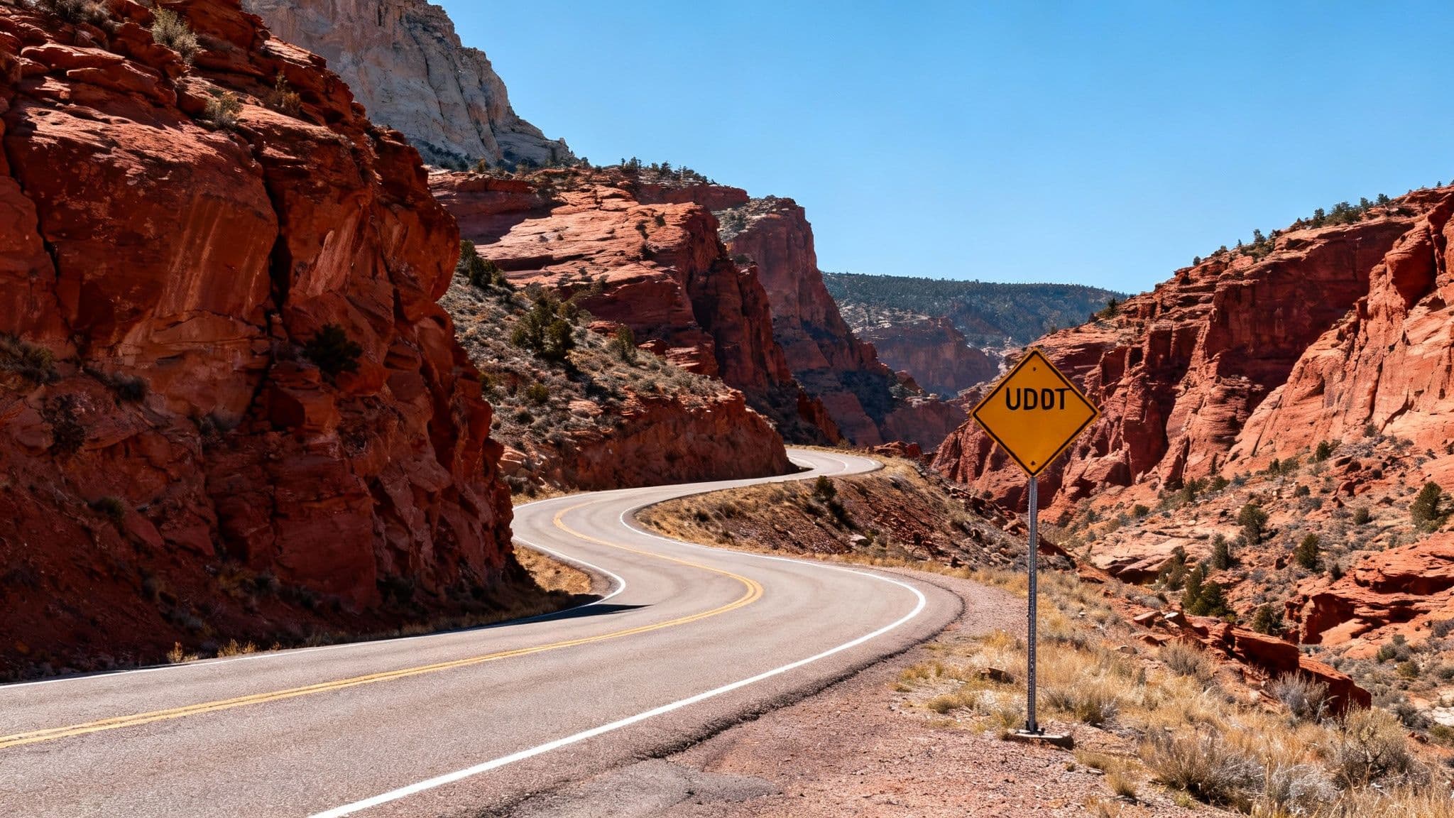
How to Check UDOT Utah Road Conditions for Canyon Travel
Your expert guide to checking UDOT Utah road conditions. Learn how to use the UDOT Traffic app, map, and live data to safely navigate the Cottonwood Canyons.
The best way to check UDOT Utah road conditions for canyon travel is by using the official UDOT Traffic website and mobile app. These free tools provide real-time traffic flow, live camera feeds, traction law status, and accident alerts, giving you a complete picture of what’s happening on canyon roads like SR-210 and SR-190 before you leave home.
This guide breaks down exactly what you need to know, when to check, and how to interpret the data to avoid traffic and stay safe on your way to the mountains.
What are the Best Tools for Checking Road Conditions?
To safely and efficiently navigate Utah’s roads, you need accurate, up-to-the-minute information. The Utah Department of Transportation (UDOT) provides two fantastic, free resources for this: the UDOT Traffic website and its companion mobile app. Think of these as your direct line to UDOT's traffic operations center, pulling live data from thousands of road sensors, traffic cameras, and on-the-ground reports into one clean interface.
The UDOT Traffic Website
The website is your command center for trip planning before you leave home. Its large, interactive map gives you a bird's-eye view of the entire state, showing real-time traffic flow, incidents, and construction.
Key website features for canyon travelers include:
- Live Traffic Cameras: Get a real-time look at key intersections and canyon roads. There's no better way to judge the weather and see how heavy traffic actually is.
- Map Layers: You can toggle different data views, letting you see active snowplow locations, road weather alerts, and seasonal closures.
- Incident Reports: Click on an icon for details about an accident, debris on the road, or any other hazard that could impact your travel.
The UDOT Traffic Mobile App
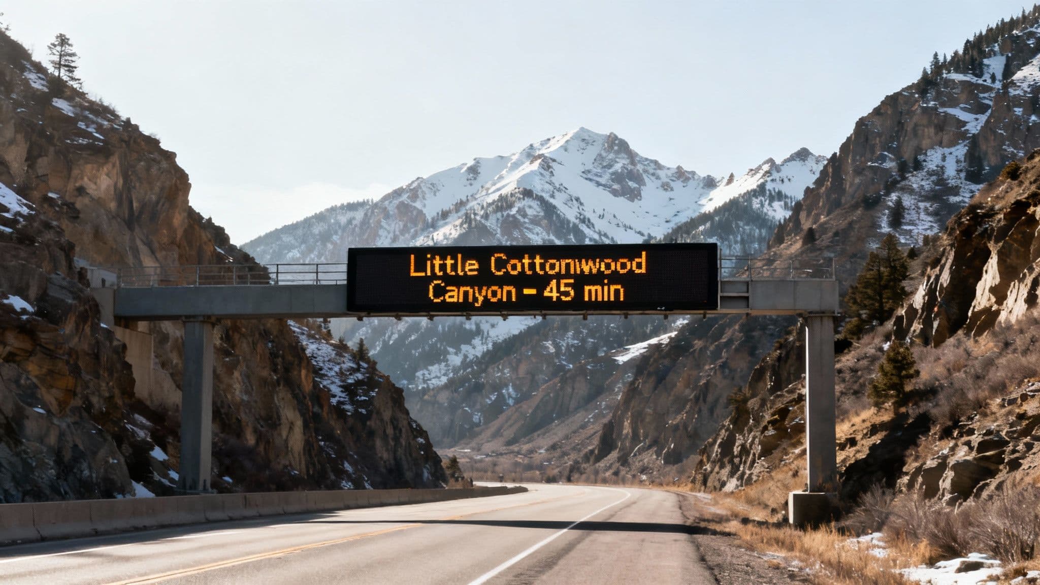
The UDOT app takes the power of the website and puts it in your pocket, adding crucial features for when you’re on the move. Its killer feature is customization: you can save specific routes—like a weekend trip up Little Cottonwood Canyon—and set up push notifications for new incidents, closures, or changes in udot utah road conditions along that specific road.
Local Tip: For anyone heading to the Cottonwood Canyons, setting up a notification for SR-210 (Little Cottonwood) or SR-190 (Big Cottonwood) is non-negotiable. It’s the difference between learning about an avalanche closure before you leave and getting stuck in traffic for hours.
For a quick visual check, our curated collection of live UDOT cameras for the canyons helps you quickly assess conditions at key checkpoints.
When Should You Check Road Conditions?
Timing is everything, especially on a powder day. Checking conditions at the right moments can save you from major headaches.
- The Night Before: Check for any overnight storm forecasts or scheduled avalanche control work. UDOT often announces morning closures for avalanche mitigation the evening prior.
- Before You Leave Home: This is your most critical check. Look at the live traffic map, camera feeds, and estimated travel times. A sudden spike in the drive time from the canyon mouth to Alta from 30 minutes to 75+ minutes is a clear sign to delay your departure.
- On the Road (Safely): If you're a passenger, use the app to monitor conditions ahead. This helps you anticipate slowdowns or know if the traction law has just been activated.
How to Read the UDOT Traffic Map
The UDOT traffic map uses a simple color-coded system and icons to give you a complete, at-a-glance overview of road conditions.
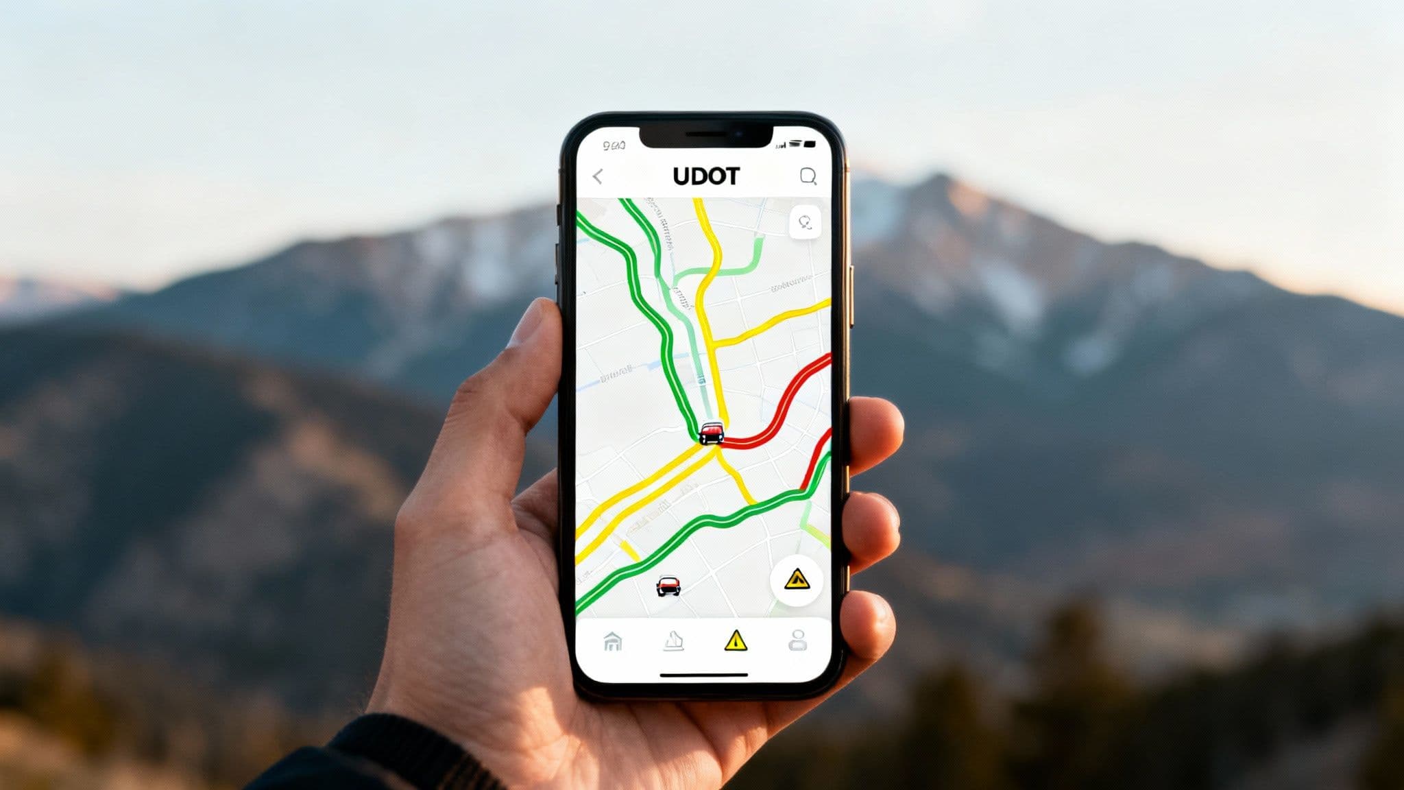
Traffic Flow Colors
Think of the map’s color system like a traffic light: green means go, yellow means caution, and red means stop—or at least, prepare for a slow crawl. These colors show you live traffic flow based on current speeds. Seeing a solid red line snaking up Little Cottonwood Canyon is your cue to wait it out.
| Color | Meaning | What It Means for Your Trip |
|---|---|---|
| Green | Clear / Moving Well | Traffic is flowing at or near the speed limit. Smooth sailing. |
| Yellow | Slowing Down | Traffic is moving below the speed limit. Add extra time. |
| Red | Heavy Congestion | Traffic is stop-and-go. Expect significant delays. |
| Black | Stopped Traffic | Traffic is at a standstill, often due to a major incident or closure. |
Map Icons and Alerts
The colored lines tell you what is happening, but the icons tell you why. Each icon is clickable, providing details on crashes, construction, or road closures. A red line on the map for Big Cottonwood Canyon paired with a crash icon tells you the delay is due to an incident that might clear once responders handle it. That context makes all the difference.
Actionable Tips for Canyon Travelers
Knowing how to check the data is one thing; using it like a local is another. Here are some actionable tips to make your canyon trip smoother.
- Cross-reference with Camera Feeds: High travel time estimates on the app? Confirm it by looking at the live UDOT cameras. If you see a long line of cars, you know the estimate is spot-on and can make a smarter call.
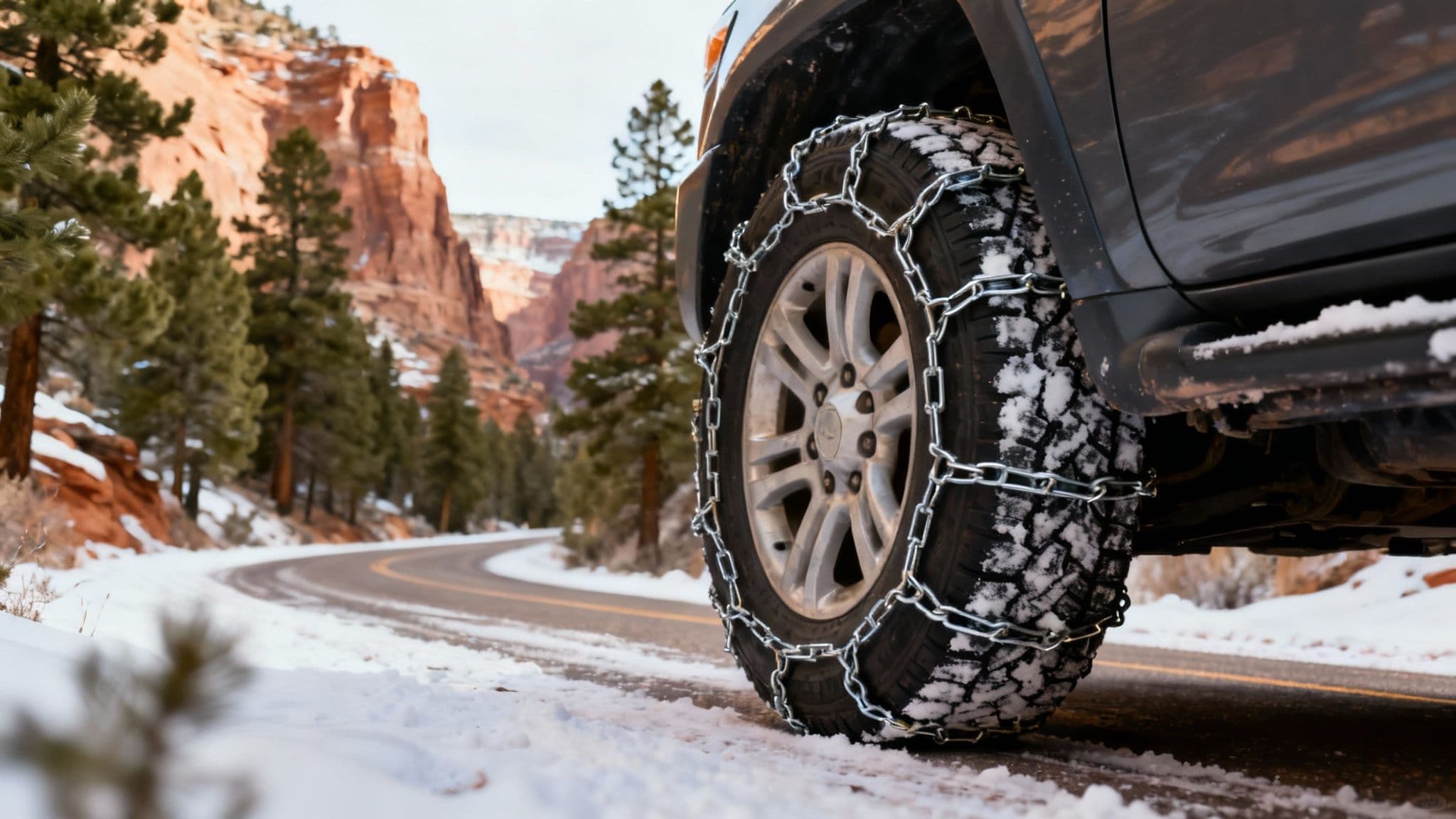
- Know the Traction Law: When conditions get slick, UDOT activates the Traction Law. This requires 4WD/AWD vehicles to have M/S or 3PMSF tires and 2WD vehicles to have 3PMSF tires or use chains. Know your vehicle's setup before you see the flashing sign.
- Check the Plow Map: The UDOT app has a map layer showing the live location of active snowplows. This gives you a great idea of which routes have been recently cleared and will likely be in the best shape for travel.
- Follow UDOT Cottonwoods on X (Twitter): For the absolute fastest updates on closures, traction law status, and reopening times for the canyons, the @UDOTcottonwoods X (formerly Twitter) feed is the primary source.
By using UDOT's powerful tools and applying these local tips, you can proactively avoid traffic jams and ensure a safe, efficient trip to enjoy Utah's incredible mountains.
Frequently Asked Questions
How often is the UDOT traffic map updated?
The UDOT traffic map is updated in near real-time. Data from road sensors refreshes every few minutes, and incident reports from highway patrol and traffic operators are posted almost as soon as they are verified.
What is the best way to check Little Cottonwood Canyon road conditions?
Combine these three sources for the clearest view:
- UDOT Traffic App: For official alerts, live traffic speeds, and camera feeds.
- UDOT Cottonwoods on X (Twitter): The fastest source for direct updates on closures or traction law changes.
- Wasatch Roads: We curate the most critical information—like traction law status and avalanche mitigation times for Little Cottonwood Canyon—in one easy-to-read format.
What does a road closure for "avalanche control" mean?
This means UDOT crews are intentionally triggering small, manageable avalanches with controlled explosives to clear unstable snow from slide paths above the road. This preventative measure is critical for safety in Big Cottonwood Canyon and Little Cottonwood. Closures can last from 30 minutes to several hours.
Stay ahead of the traffic and make your next canyon trip a breeze. Wasatch Roads provides curated, real-time road and weather information specifically for your mountain adventure. Visit us at https://wasatchroads.com to plan your perfect day on the slopes.