Your Guide to the Alta Ski Area Snow Report: How to Read the Numbers
Planning a trip up Little Cottonwood Canyon? Learn how to read the Alta Ski Area snow report, from current conditions and live data to historical patterns, to find the best powder.
The Alta Ski Area snow report is your key to planning the perfect day in Little Cottonwood Canyon. This guide explains what the live data means, how to interpret it for the best on-mountain conditions, and when to visit based on historical trends. Use these local tips to find the best powder and know exactly what to expect before you drive up.
What is in the Alta Snow Report?
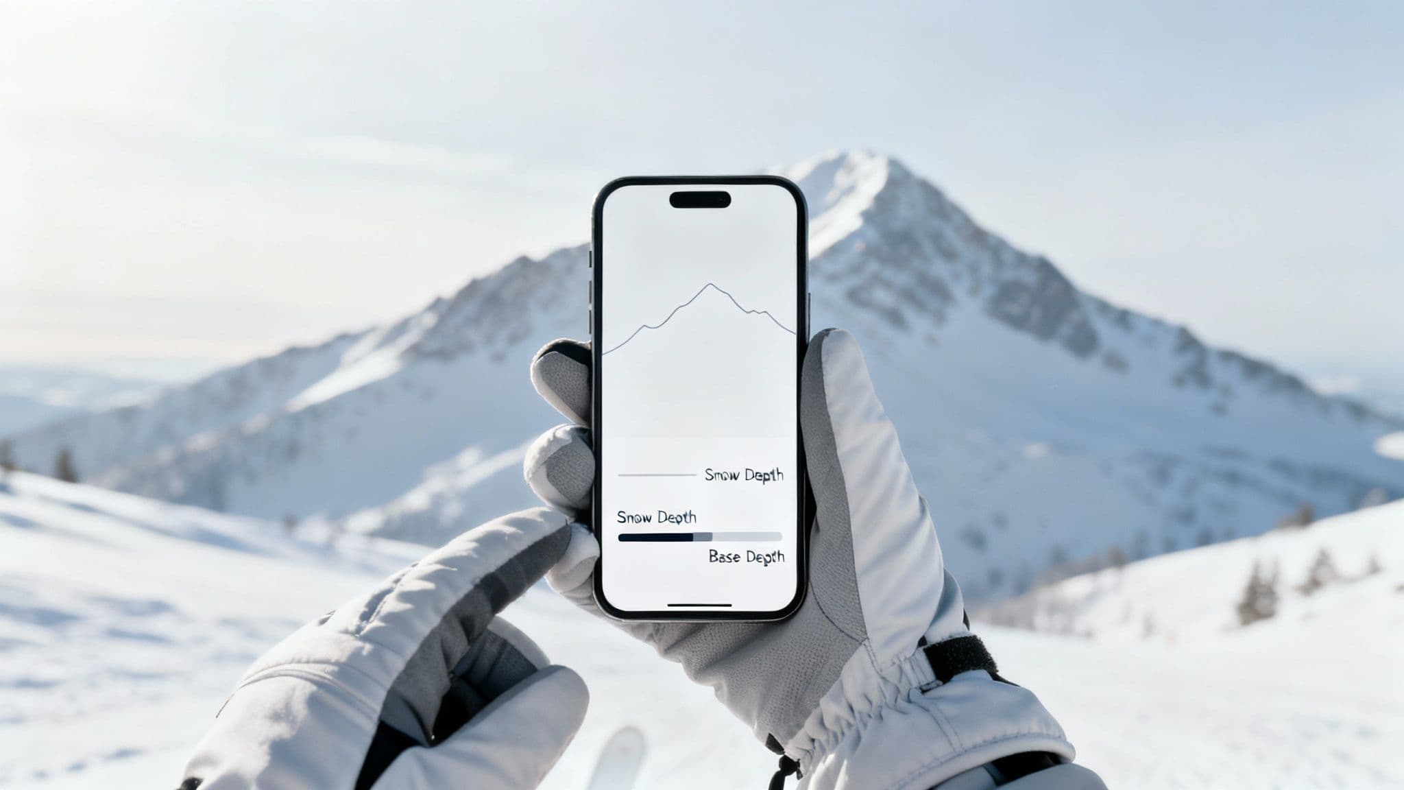
The snow report provides a real-time snapshot of mountain conditions, from new snowfall to the total base depth. Before you leave the house, you can check this live data to see if it's a deep powder day or if coverage is solid. The table below gives you the most critical numbers at a glance.

Here's a breakdown of the current conditions from our live data feed:
| Metric | Current Data | What It Means |
|---|---|---|
| 24-Hour Snowfall | 12 inches | Fresh snow for powder turns. |
| Settled Base Depth | 125 inches | Total depth at mid-mountain; excellent coverage. |
| Year-to-Date Snowfall | 515 inches | Tracks progress toward the 500+ inch average. |
Understanding these numbers is fundamental to planning a great ski day. A deep base means rock-solid coverage across the mountain, while significant new snow is the recipe for the floaty powder turns Alta is famous for.
How to Translate the Numbers
Here's how to turn those metrics into on-the-ground reality:
- 24-Hour Snowfall: This is your powder potential. Anything over 6 inches is a great sign, and double-digit numbers mean an epic day.
- Settled Base Depth: Think of this as the mountain's foundation. A base over 100 inches ensures most obstacles are buried and off-trail terrain is filled in.
- Year-to-Date Snowfall: Alta consistently gets over 500 inches a year. This metric shows how the current season stacks up against that legendary average.
Local Tip: Always check the road status before you drive. The same storms that deliver amazing snow can make getting there a challenge. Review the latest Little Cottonwood Canyon conditions to avoid surprises.
How to Interpret the Alta Snow Report
Knowing how to read the numbers on an Alta snow report can turn a good ski day into a great one. Learning to interpret the data like a local helps you pinpoint which lifts to hit and what terrain will be skiing best based on the day's specific conditions.
Think of the settled base depth as the foundation for the entire ski season. This is the total compacted snow on the ground at a specific mid-mountain location. When the base gets over 100 inches, coverage is solid, and more of Alta's legendary off-piste terrain opens up.
But new snowfall is the number everyone watches. This metric tells you how much fresh powder has fallen in the last 12, 24, or 48 hours. It's the key to knowing if you're in for a legitimate powder day.
Key Snowfall Metrics Explained
Digging deeper into the report gives you tactical details to decide where to ski and when to go.
- Snow Depth vs. Base Depth: Snow depth can be measured anywhere, but the official base depth is always taken at the same spot. This consistency makes it a reliable benchmark for tracking the season.
- Year-to-Date (YTD) Snowfall: This is the running total for the entire season. Alta's average annual snowfall blows past 500 inches, making it one of the snowiest resorts in North America. You can see how its historical data stacks up by exploring its snow history.
- Storm Totals: This figure shows how much snow a single storm system delivered from start to finish. Big storm totals are a clear sign of multi-day powder opportunities.
For a deeper dive into Wasatch weather, check our ski resort weather forecast guide. Understanding these details helps you anticipate conditions before driving up the canyon.
When Does Alta Get the Most Snow?
To plan the perfect Alta trip, look beyond the daily snow report to the mountain’s seasonal rhythm. Historical snowfall data helps you match your vacation to the kind of skiing you want, whether it's deep powder in January or sun-drenched corn snow in April.
Alta's historical data reveals a clear pattern. The season's heaviest storms reliably hit from January through March, with monthly totals often soaring past 100 inches. This is when the legendary deep, light-density powder piles up, building the stable base that opens up the resort's most challenging terrain. For a broader look, you can explore more insights on historical snow patterns.
What to Expect Each Month
Every part of Alta's season has its own unique character. Knowing the historical averages helps you pick the perfect window for your visit.
- November-December: The early season is about base-building. The first big storms roll through, and while coverage can be thin, you can often find soft snow without mid-season crowds.
- January-February: This is prime time. It’s the heart of winter, with cold temperatures and consistent storms delivering the light, dry "Greatest Snow on Earth®" Alta is famous for. Your odds of hitting a massive powder day are at their peak.
- March-April: March often boasts the deepest base of the year, serving up a mix of major winter storms and bluebird days. April transitions to classic spring skiing, with soft corn snow perfect for long, sunny afternoons.
By the end of February, it's not uncommon for Alta's year-to-date snowfall to have already blown past 350-400 inches, setting the stage for an amazing spring.
Average Monthly Snowfall and Base Depth at Alta
This table gives you a historical look at what to expect for snow conditions during each month of the ski season.
| Month | Average New Snowfall (Inches) | Typical End-of-Month Base Depth (Inches) |
|---|---|---|
| November | 68 | 45 |
| December | 91 | 79 |
| January | 98 | 111 |
| February | 93 | 134 |
| March | 96 | 148 |
| April | 61 | 141 |
While every winter has its own personality, these averages provide a solid baseline for planning your trip.
What Makes Alta's Snow So Good?
Alta's "Greatest Snow on Earth" claim isn't just marketing—it's a meteorological reality. That exceptionally light, dry powder is the result of a perfect geographic and atmospheric recipe, powered by the lake effect and orographic lift.
It starts when cold air blows across the Great Salt Lake. This lake effect allows the air to soak up moisture, priming it for a big dump. Once that moisture-heavy air slams into the Wasatch Mountains, it’s forced upward in a process called orographic lift. As the air rises, it cools rapidly and unloads its contents as incredibly light, fluffy snow.
This one-two punch creates an ideal snow-to-liquid ratio. While a typical storm might have a 10:1 ratio (10 inches of snow per 1 inch of water), Alta's storms frequently deliver ratios of 15:1 or even 20:1. That’s the low-density, cold-smoke powder skiers dream about.
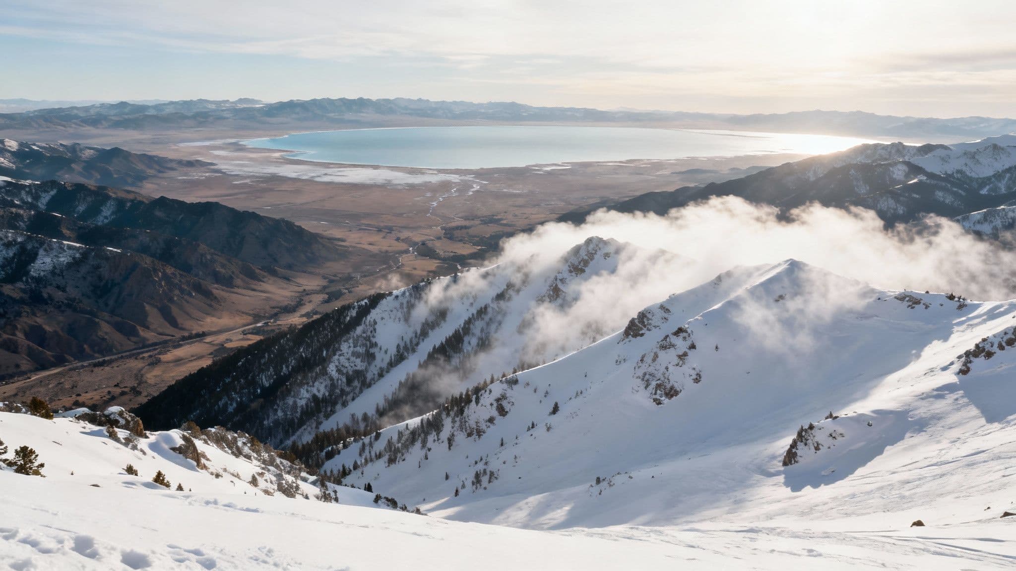
The unique geography of Little Cottonwood Canyon acts as a perfect snow-catcher. Its steep, narrow walls efficiently channel storms, maximizing snowfall. This is why Alta's base depth often outpaces neighboring areas, even those in Big Cottonwood Canyon.
How to Stay Safe at Alta
All that legendary snow comes with a serious responsibility. Because Alta sits in prime avalanche terrain, understanding the risks is non-negotiable. Before every trip up the canyon, your first step should be checking the daily forecast from the Utah Avalanche Center (UAC).
The UAC provides detailed information on snowpack stability, potential avalanche problems, and an overall danger rating. This forecast is the single most important piece of information for anyone skiing near or outside the resort boundaries. Ignoring it puts you and others at serious risk.
Tips for Avalanche Terrain
Even inside the resort, ropes are there for a reason. Venturing into closed areas or the backcountry requires specific knowledge, the right gear, and a solid plan.
- Carry the Right Gear: Never enter the backcountry without a beacon, shovel, and probe, and know how to use them.
- Never Go Alone: Always ski with a partner and practice rescue scenarios.
- Read the Forecast Daily: The alta ski area snow report tells you about the powder, but the UAC forecast tells you about the danger. Make it a daily habit to check the Utah Avalanche Center before you leave the house.
A "Considerable" danger rating means human-triggered avalanches are likely. It’s critical to understand these ratings to make smart decisions.
Actionable Tips for Your Alta Ski Day
Reading the snow report is one thing; turning those numbers into a game plan is how you win the day. A smart strategy helps you find the best snow and steer clear of crowds.
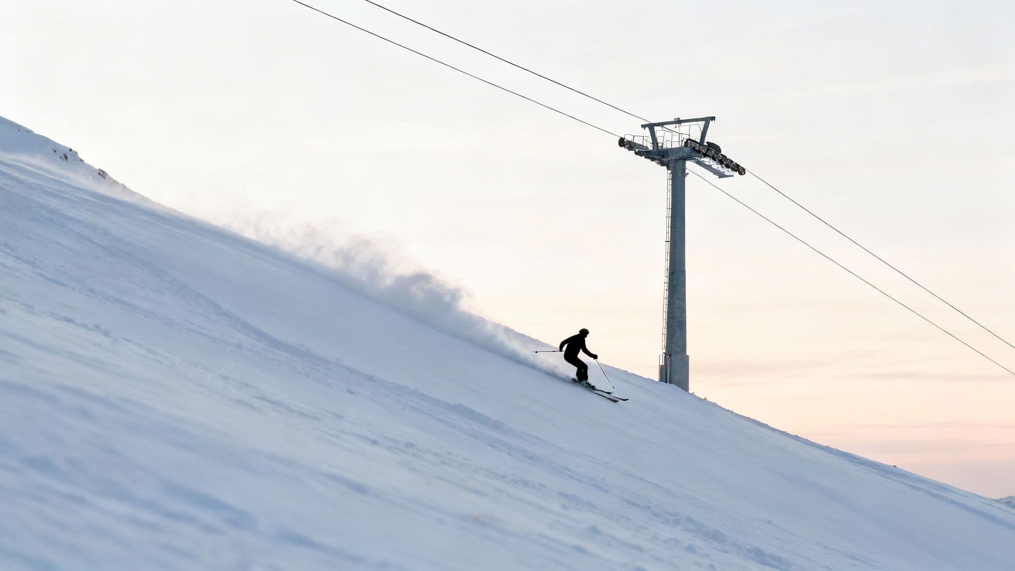
The right lift choice can make or break your powder day. A little forethought means you'll be finding untouched stashes long after the first tracks have been laid down.
Where to Ski Based on the Snow Report
Here’s a quick guide to help you make your first move when the lifts start spinning:
- 10+ Inches of New Snow: Make a beeline for the Collins or Supreme lifts. These chairs serve Alta's classic, steep terrain where deep powder hides. Think High Rustler or the lines off the High Traverse.
- Firm or Groomed Conditions: When fresh snow is a distant memory, Wildcat is your best bet. It accesses some of the best groomers on the mountain, perfect for high-speed carves.
- Spring Corn Snow: On warm, sunny afternoons, follow the sun. Start on east-facing slopes off the Sugarloaf lift, then move to west-facing terrain as the snow softens into perfect corn.
Local Tip: A big storm almost always means challenging road conditions. Heavy snowfall can trigger road closures in Little Cottonwood Canyon with little warning. Check our Little Cottonwood Canyon winter driving guide for crucial road rules and live updates before you go.
Alta Snow Report FAQ
How accurate is the Alta snow report?
It's very accurate. Alta uses a mix of automated SNOTEL sites and manual measurements taken by seasoned ski patrollers at the same spots every day. This means the numbers reflect what’s actually on the ground.
What's the difference between Alta and Snowbird snow totals?
Though neighbors, Alta consistently reports slightly higher snow totals. Alta sits at the very back of Little Cottonwood Canyon, a perfect spot for orographic lift to wring every last snowflake out of incoming storms.
When is the best time to ski powder at Alta?
For deep, light powder, your best bet is between late January and early March. This is the heart of winter in Little Cottonwood, when historical data shows the coldest temps and most consistent storms deliver legendary "Alta-deep" powder days.
For real-time road conditions and traffic updates for your trip up the canyon, check Wasatch Roads at https://wasatchroads.com.