How to Read a Ski Resort Weather Forecast for the Cottonwood Canyons
Master the ski resort weather forecast for Utah's canyons. Learn to decode snow reports, wind, and visibility to plan the perfect powder day in Little Cottonwood and Big Cottonwood Canyon.
Knowing how to read a ski resort weather forecast is the key to a great day in the Cottonwood Canyons. Beyond just temperature, a detailed forecast reveals crucial details like wind speed, new snow totals, and visibility that separate a perfect powder day from an icy, frustrating one. This guide explains what to look for, when to check, and how to use live data to make the best call.
Let's break down exactly what matters for canyon travelers.

What Makes a Mountain Forecast Different?
Your standard city forecast won't cut it for the slopes in the Wasatch. Mountain weather is driven by massive elevation swings and complex terrain that create unique, localized conditions. The weather at the mouth of Little Cottonwood Canyon can be calm, while a few thousand feet higher at Alta, a blizzard is raging.
How Elevation and Terrain Shape Canyon Weather
- Elevation Gain: As a rule of thumb, the temperature drops 3-5°F for every 1,000 feet you climb. This "lapse rate" is why the base lodge might see rain while the upper mountain gets hammered with fresh powder.
- Topography: Canyons and ridges act like funnels for weather. A storm hitting Big Cottonwood Canyon might dump a foot of snow at Brighton while a resort over the ridge gets only a few inches, all because of how the mountains steer the moisture.
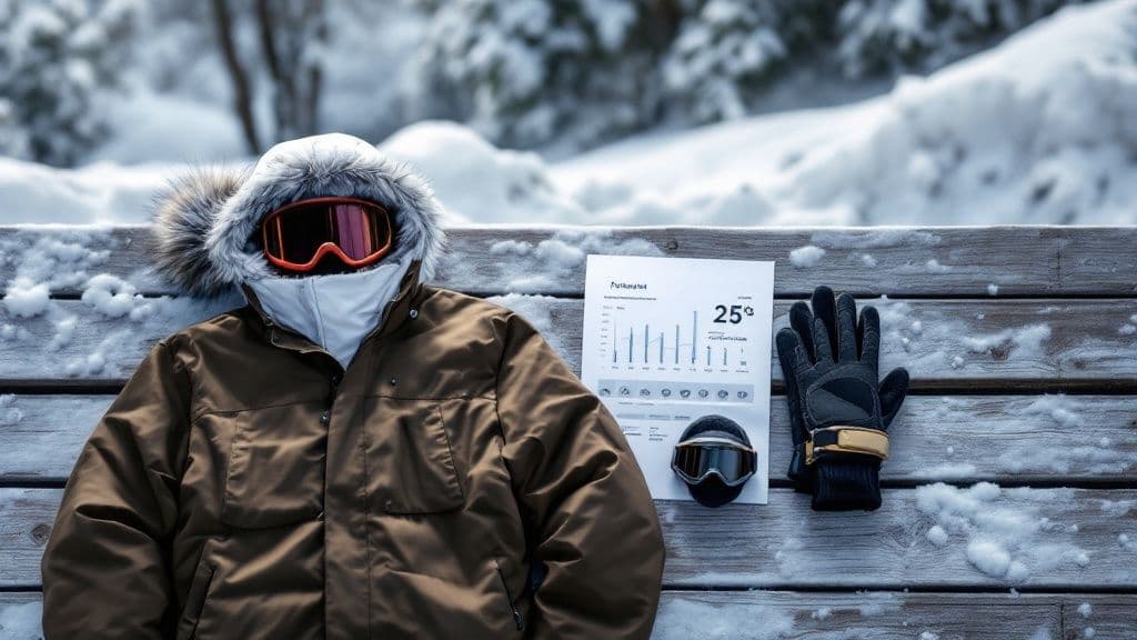
What to Look for in a Snow Report
Think of a snow report as the mountain’s daily story, not just a single number. Looking past the flashy snowfall total is key to understanding what you’ll find on the slopes. The numbers that truly matter tell you about the quality and coverage of the snow.

How to Deconstruct the Snowpack
The foundation of a good ski day is the snow depth (or snowpack)—the total accumulated snow on the ground. A deep, solid base means better coverage over rocks and other hazards. Pay attention to the difference in depth between the base and summit. A report showing 30 inches at the base and 60 inches at the summit tells you the upper mountain has much better coverage and directs you toward higher-elevation runs.
How to Interpret New Snow Totals
This is the most exciting part of the report, but context is everything. Always look for snowfall broken down by timeframe.
- New Snow in 24 Hours: This is your snapshot of immediate conditions. Six inches of fresh powder means a great day.
- New Snow in 48-72 Hours: This is your secret weapon for finding leftover powder. A storm that dropped a foot two days ago means untracked lines are still hiding in the trees.
Aggregators like OnTheSnow.com compile 72-hour totals to help you compare mountains. Our live data on the Alta snow report breaks down these metrics specifically for Little Cottonwood Canyon. A solid base with a few inches of new snow can be fantastic, while a huge dump on a thin base might still hide obstacles.
How Wind and Visibility Affect Your Day
Perfect powder means nothing if you’re getting blasted by wind or can’t see five feet ahead. Wind and visibility can turn a promising powder day into a miserable—and hazardous—one. High winds cause dangerous wind chill and can shut down chairlifts, cutting off access to terrain. Wind also scours snow off exposed ridges, leaving ice behind, while depositing it in deep drifts on protected slopes.

How to Navigate Low Visibility
Poor visibility from fog or heavy snow can be disorienting. A common challenge is flat light, which occurs on overcast days when diffused light erases shadows, making it impossible to see bumps or moguls.
Actionable Tip for Low-Visibility Days
When the forecast calls for poor visibility, your game plan has to change. Forget open bowls and head for the trees. The contrast from tree trunks provides the reference points your eyes need to read the terrain.
- Stick to Tree-Lined Runs: At resorts like Brighton, runs with trees on either side provide crucial visual anchors.
- Wear the Right Goggles: Low-light lenses (yellow, amber, or rose-colored) boost contrast and make details in the snow pop.
- Ski with a Buddy: Stay close and follow their tracks to anticipate terrain changes you might not see on your own.
Where to Find a Reliable Mountain Forecast
Your standard phone app is often dangerously wrong for a ski resort forecast. Most generic apps pull data from sensors in the valley, so they miss the impact of elevation. It is critical to use mountain-specific sources that provide forecasts for the base, mid-mountain, and summit.
Recommended Forecasting Tools
To get the real story, use specialized tools that have dedicated meteorologists who live and breathe mountain weather.
- OpenSnow: The go-to source for skiers, OpenSnow provides detailed 10-day forecasts and daily reports from local experts.
- National Weather Service (NWS): The NWS offers granular point forecasts. You can click a specific mountain on their map to get a forecast for that exact elevation.
- Utah Avalanche Center: The Utah Avalanche Center provides critical weather discussions alongside stability reports, which are invaluable for understanding a storm's behavior.
Actionable Tip for Reading Reports
Look past the simple snowfall number and dig into the hourly data. An hourly chart showing temperatures dropping from 33°F to 25°F in the afternoon tells a crucial story: morning slush is going to turn into afternoon ice. For a deep dive into local conditions, check our comprehensive Wasatch snow forecast, which synthesizes data specifically for our unique canyons.
When to Plan Your Trip Using Historical Data
When booking a ski trip months out, a 5-day forecast is useless. Instead, use historical weather data to make an educated guess on when a resort will have its best snow. By digging into a resort's past performance, you can spot patterns that boost your odds of scoring epic conditions.
How to Analyze Historical Snow Data
The two most valuable metrics are average monthly snowfall and historical snow depth charts.
First, look at the average snowfall for each month. For resorts in Utah's Little Cottonwood Canyon, late January through early March is often the sweet spot. Next, dive into snow depth charts. These graphs show how the snowpack builds over entire seasons, revealing when the base typically hits its deepest point. A resort with a consistently deep base by mid-January is a much safer bet for an early-season trip.
How to Find a Resort's Prime Time
Using these tools, you can identify a resort’s prime time. You're looking for the weeks that historically combine the highest average snowfall with the deepest snowpack. For example, you can learn more about historical snow patterns at Snow-Forecast.com to see how data can help pinpoint those peak weeks. This is how you find coveted "Bluebird Powder Days"—fresh snow followed by sunshine.
Your Pre-Trip Weather Checklist
Turn forecast data into simple, smart decisions with a pre-powder day ritual. This checklist breaks down what to look for and when, so you'll know what gear to grab and where the best snow is hiding.
When to Check: 7 Days Out (The Big Picture)
A week out is for spotting major patterns. Don't focus on exact snowfall totals yet.
- Spot Potential Storms: Use a site like OpenSnow to look at long-range models. Is a multi-day storm cycle lining up with your trip?
- Track Temperature Trends: Check for sustained cold or a major warm-up to get an early read on snow quality.
When to Check: 3 Days Out (Refine the Details)
With 72 hours to go, the forecast gets much sharper. Now you can dial in your expectations. The forecast will tighten up, giving you a clearer range like 4-8 inches instead of a vague “chance of snow.” This is the time to read daily discussions from local forecasters, who explain how a storm might behave in specific Wasatch terrain. For more on that, read our guide to Wasatch weather patterns.
When to Check: The Night Before (Final Prep)
This is your final, most important checkpoint to lock in the game plan.
- Check Hourly Wind and Temps: Will high winds affect upper mountain lifts in the morning? Will a temperature drop create afternoon ice?
- Confirm Lift and Terrain Status: Check the resort's official website for the morning snow report, wind holds, and new terrain openings.
- Review Overnight Snowfall: How much fresh snow actually fell? This is the final piece of the puzzle.
Ski Forecast FAQ
How far out is a ski forecast reliable?
A ski resort weather forecast becomes dependable within 3 to 5 days. The long-range outlook is good for spotting potential storms, but specifics like snowfall totals will change. Check again 24 to 48 hours out for details like wind and snow quality, and do a final check the morning of your trip.
What’s the difference between snowfall and snow depth?
Snowfall is the new snow that has fallen in a specific timeframe (e.g., 24 hours). Snow depth (or snowpack) is the total accumulated snow on the ground, including old and new layers. You need both numbers: depth tells you about coverage and trail openings, while snowfall tells you what kind of surface you'll be skiing on.
Why is the valley forecast so different from the resort's?
Elevation is the main reason. The temperature drops roughly 3 to 5°F for every 1,000 feet you climb. This is why it can be raining in the valley while it's dumping feet of powder at the summit. Mountains in Little Cottonwood Canyon create their own weather through a process called orographic lift, making specialized mountain forecasts essential.
At Wasatch Roads, we pull together real-time road conditions, live camera feeds, and weather data to give you the clearest picture of what's happening in the canyons. Before you head up, check our live updates to make your trip safer and more enjoyable. Find all the information you need at https://wasatchroads.com.