A Canyon Traveler's Guide to Wasatch Weather
Planning a trip to Little or Big Cottonwood Canyon? This guide breaks down Wasatch weather patterns by season, explaining the science behind the snow and providing actionable tips to stay safe.
Wasatch weather is defined by four distinct, intense seasons that can swing from deep powder days to violent summer thunderstorms. This dramatic variation means conditions in the canyons can change in a heartbeat, making it critical to understand local patterns before you head up. This guide breaks down what to expect season by season and how to use live data to plan a safe and successful trip.
Whether you're planning a ski trip to Little Cottonwood Canyon or a summer hike in Big Cottonwood Canyon, knowing the seasonal playbook is your first step toward a safe day in the mountains.
What Are the Four Seasons of Wasatch Weather?
The Wasatch Mountains don't just have weather; they have personalities that shift dramatically with each season. What makes a perfect bluebird ski day in February can create treacherous avalanche conditions in April. Understanding these fundamental patterns is non-negotiable for any canyon traveler.
- Winter (December - March): This is the main event, defined by cold temperatures and an average of 500 inches of snow. World-class skiing is paired with high avalanche danger and frequent road closures.
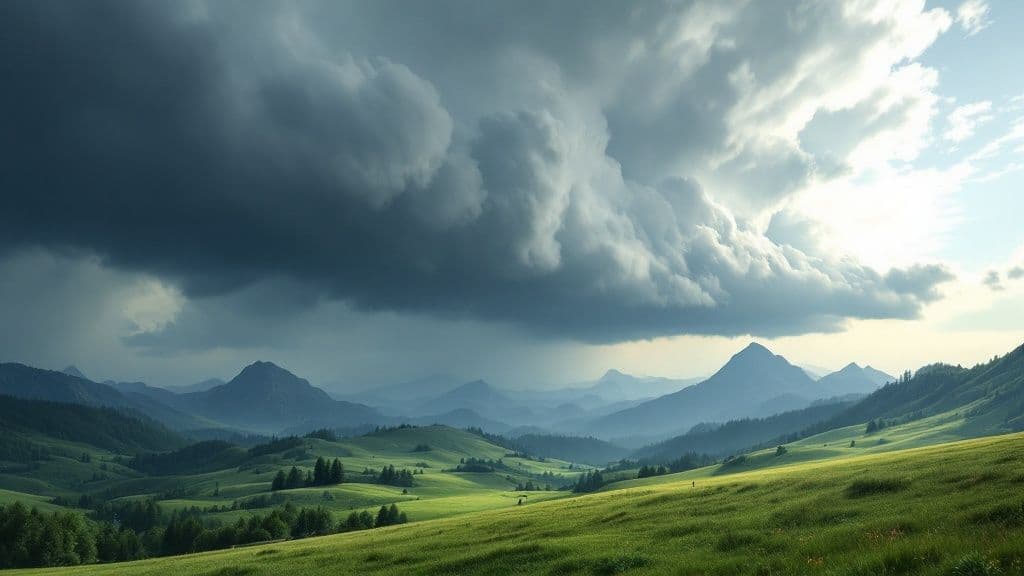
- Spring (April - June): This "shoulder season" is the most volatile. Rapid warming creates dangerous wet slab avalanches and flooding from snowmelt, with weather swinging from snowstorms to 70-degree days.
- Summer (July - September): Warm, dry mornings often give way to powerful afternoon thunderstorms due to the North American Monsoon. Lightning and flash floods are serious risks.
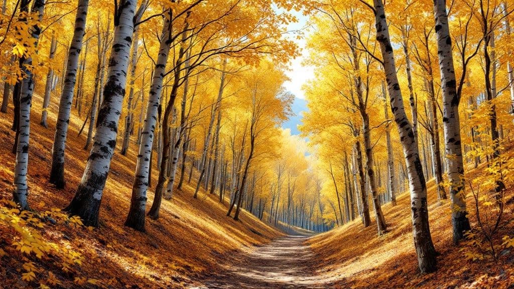
- Fall (October - November): This season offers a brief window of stable, pleasant weather perfect for hiking and climbing. However, the first big snowfalls often arrive by late October, catching unprepared visitors by surprise.
Local Tip: The elevation change is a critical factor. For every 1,000 feet you climb, the temperature can drop by 3-5°F. A mild day in Salt Lake City is no guarantee of similar conditions at Alta or Brighton.
Wasatch Weather by the Numbers
To give you a quick reference, here’s a breakdown of what to expect throughout the year in the canyons.
| Season | Typical Temperature Range (°F) | Common Weather and Hazards | Recommended Canyon Activities |
|---|---|---|---|
| Winter | 10° - 35° | Heavy snowfall, powder days, high avalanche risk, road closures, sub-zero wind chills. | Skiing, snowboarding, snowshoeing, backcountry touring (with proper gear and training). |
| Spring | 30° - 65° | Rapidly melting snow, wet slab avalanches, mudslides, unpredictable snowstorms, high rivers. | Spring skiing ("corn" snow), low-elevation hiking, road biking as roads clear. |
| Summer | 55° - 85° | Sunny mornings, afternoon thunderstorms, lightning, flash floods, wildfire smoke. | Hiking, rock climbing, mountain biking, fishing, scenic drives, wildflower viewing. |
| Fall | 35° - 70° | Stable, clear days, crisp nights, first snowfalls, icy patches in shady areas. | Hiking among fall colors, rock climbing, trail running before the snow arrives. |
What Creates "The Greatest Snow on Earth®"?
You’ve seen it on the license plates. The phrase "The Greatest Snow on Earth" is rooted in the unique geography of the Wasatch Mountains, which combines two key weather phenomena to produce light, dry, and incredibly deep powder. Understanding this helps explain why a Salt Lake City forecast is useless for the canyons.

Orographic Lift: How Mountains Make Snow
The first key ingredient is orographic lift. When moist air from Pacific storms hits the Wasatch Front, it's forced to rise rapidly. As the air climbs thousands of feet, it cools, expands, and dumps its moisture as highly concentrated snowfall on the western slopes, particularly in the Cottonwood Canyons.
This effect is why the canyon entrance gets around 100 inches of snow a year, while Alta and Snowbird—just seven miles up the road—average over 500 inches.
The Great Salt Lake Effect
The second ingredient is the lake effect. In early winter, the Great Salt Lake is much warmer than the cold air passing over it. This pumps moisture into the air, creating clouds. When this newly moistened air hits the mountains, orographic lift squeezes out the extra moisture as incredibly light, low-density snow. This one-two punch is what gives Utah snow its legendary reputation.
To get ahead of these storm cycles, check our detailed Wasatch snow forecast for the most up-to-date information before you head up.
How Do I Travel Safely in the Canyons?
Safely navigating the Wasatch requires a different approach for each season. Winter demands respect for hazardous roads and avalanches, while summer requires awareness of flash floods and lightning. Here are actionable tips for staying safe year-round.
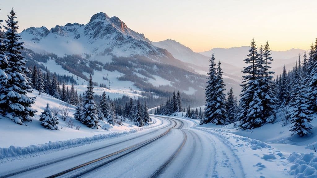
Winter Safety: Roads and Avalanches
The roads up Little Cottonwood Canyon and Big Cottonwood Canyon are steep and treacherous. Utah’s Traction Law is mandatory during storms.
- 4WD/AWD vehicles need tires with a 3-Peak Mountain Snowflake (3PMSF) or Mud and Snow (M+S) rating.
- 2WD vehicles must have 3PMSF tires or use traction devices like chains.
Road closures are common for avalanche mitigation. If a major storm is in the forecast, assume the road may be closed the next morning. For backcountry travel, always check the Utah Avalanche Center (UAC) forecast and carry a transceiver, shovel, and probe.
Spring and Summer Safety: Floods and Lightning
As the snowpack melts in spring, it creates two major hazards: wet slab avalanches and flooding. Creeks become raging torrents, and the saturated snowpack can slide unexpectedly. The golden rule for spring backcountry is to start early and be off the snow before the afternoon sun turns it to mush.
In summer, the North American Monsoon creates a classic pattern of clear mornings followed by fast-building afternoon thunderstorms.
- Start Early: Plan to be off summits and exposed ridges by noon.
- Watch the Sky: Constantly look for building cumulus clouds.
- Have an Escape Plan: Know your route to lower, safer terrain.
For a closer look at summer conditions at higher elevations, see our guide on the weather at Snowbird, Utah.
How Can I Use Live Data to Plan My Trip?
The best way to make a safe go/no-go decision is to use real-time data. This shifts you from reacting to the weather to proactively planning for what's actually happening in the canyons.
Where to Find Actionable Data
Your phone's general weather app isn't enough. For reliable information, use these three key resources:
- WasatchRoads.com: Our site provides live road status, travel times, and weather metrics pulled directly from sensors in the canyons.
- National Weather Service (NWS): Use the point forecast feature to get a forecast for a specific peak or elevation, which is far more accurate than a city forecast.
- Utah Avalanche Center (UAC): During winter, this is a non-negotiable daily check for expert snowpack analysis and danger ratings.
Local Tip: Before you even leave home, check our live Little Cottonwood Canyon cameras to see current visibility, road conditions, and cloud cover for yourself.
How Is Climate Change Affecting Wasatch Weather?
Beyond the daily forecast, long-term climate trends show a clear warming pattern in the Wasatch Range. This shift is changing everything from our snowpack to the length of the wildfire season.
Records show that Utah's temperatures have risen more than 2.5°F since 1900, with 8 of the 10 hottest years occurring since 2012. You can read the full report on Utah's changing weather patterns for more detail.
This trend has tangible consequences for the mountains:
- Reduced Snowpack: More storms drop rain instead of snow, especially at lower elevations, leading to a less reliable snowpack.
- Increased Wildfire Risk: Warmer springs and earlier snowmelt result in a longer, drier summer, extending the wildfire season.
- Stressed Water Resources: A smaller snowpack puts a major strain on the water supply for the entire Salt Lake Valley.
Wasatch Weather FAQ
When is the best time to visit the Wasatch Mountains?
It depends entirely on your activity. For skiing and snowboarding, mid-December through March is ideal for deep, consistent snow. For hiking, mountain biking, and climbing, July through September offers snow-free trails and stable weather (but watch for afternoon thunderstorms).
What are the winter road rules for the Cottonwood Canyons?
During winter storms, Utah's Traction Law is mandatory in both Little Cottonwood Canyon and Big Cottonwood Canyon. Your vehicle must have either 4WD/AWD with M+S or 3PMSF tires, or be a 2WD vehicle equipped with traction devices like chains. Always check the live road status before you drive up.
Why is mountain weather so different from the city forecast?
Elevation is the biggest factor. The temperature drops about 3-5°F for every 1,000 feet you climb. Additionally, mountains create their own weather through orographic lift, forcing moist air to rise, cool, and dump precipitation. Never trust a valley forecast for your mountain plans.