Your Guide to Cottonwood Heights Weather for Canyon Travel
Planning a trip up Little or Big Cottonwood Canyon? Understand how Cottonwood Heights weather differs from the canyons, what to expect each season, and how to read official reports for a safe drive.
Planning a trip up the canyons from Cottonwood Heights requires more than a quick glance at a city forecast. Conditions at the base are often misleading; a clear day in the valley can hide a full-blown blizzard just a few thousand feet higher in Little or Big Cottonwood Canyon. This guide translates local weather patterns into actionable advice, helping you understand what to expect, when to go, and how to prepare for a safe journey.
What is the Weather Like in Cottonwood Heights?
The weather in Cottonwood Heights sets the stage for what happens at higher elevations. Each season has a distinct personality, from hot, dry summers perfect for hiking to the legendary winters that bring "The Greatest Snow on Earth®." Understanding this seasonal rhythm helps you pack the right gear and set the right expectations for your trip into Big Cottonwood Canyon or Little Cottonwood Canyon.
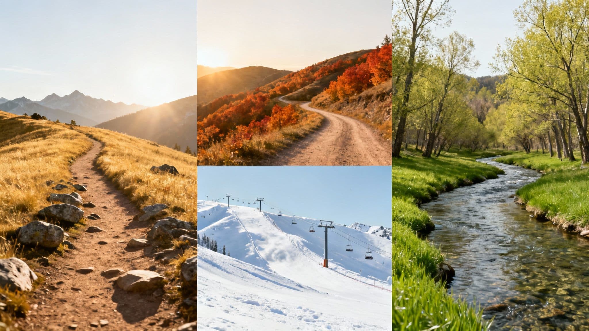
Summer (June-August)
Summers are hot and dry, with daytime temperatures often climbing into the 80s and 90s. This is prime time for hiking and biking, but it also brings predictable afternoon thunderstorms. These storms build quickly in the mountains, bringing dangerous lightning and sudden downpours.
- Actionable Tip: Start any canyon activity early in the morning to be off the peaks and back below the treeline before storms roll in.
Fall (September-November)
Autumn offers crisp, cool days perfect for enjoying the fall colors. It's a season of transition—a warm, sunny day can be followed by the first dusting of snow at the peaks a week later. Temperature swings between the valley and the resorts are significant.
- Actionable Tip: Dress in layers. A t-shirt, fleece, and waterproof shell will prepare you for a 30-degree temperature difference between the canyon base and its summit.
Winter (December-March)
Winter weather is the most critical factor for canyon travel. Heavy snowstorms are frequent, creating world-class skiing but also challenging driving conditions. Average lows can drop to 17°F (-8°C), and these storms regularly trigger traction laws and road closures.
- Actionable Tip: Always check the Utah Department of Transportation (UDOT) road status before you leave. Ensure your vehicle has snow-rated tires (M+S or 3PMSF).
Spring (April-May)
Spring is wildly unpredictable; it’s common to see sun, rain, and snow in a single day. As the massive snowpack melts, lower-elevation trails become muddy and slushy. This is also a time of heightened avalanche danger due to warming temperatures.
- Actionable Tip: Always check the Utah Avalanche Center (UAC) forecast, even for spring skiing. The warming snowpack can create dangerous wet slab avalanches.
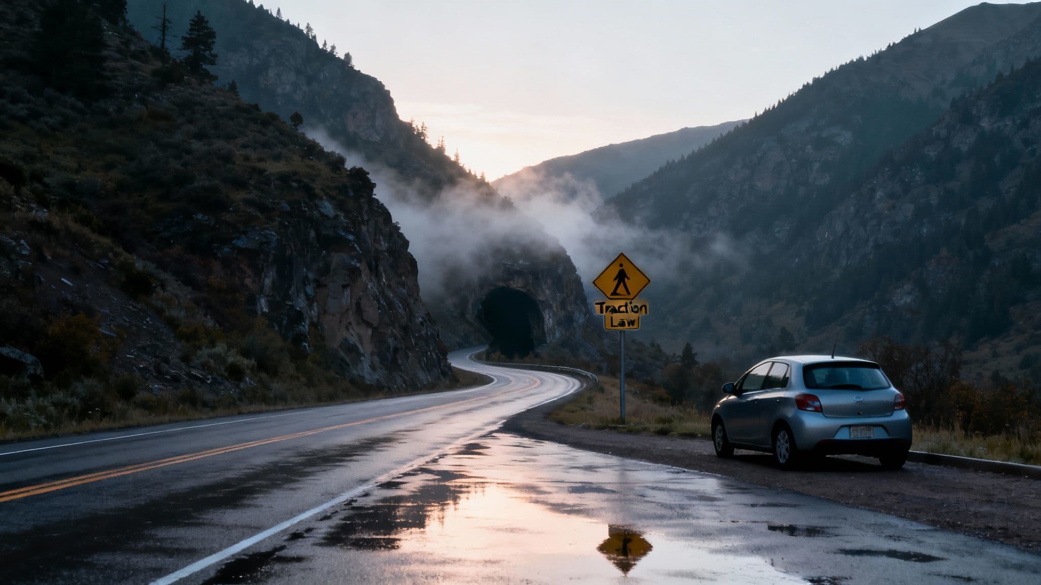
Why is Canyon Weather Different from Valley Weather?
Assuming the weather in Cottonwood Heights is the same as the weather at Alta or Brighton is a classic and dangerous mistake. The Wasatch Mountains create their own localized climate due to a massive elevation gain of nearly 4,000 feet, steep canyon walls, and the "lake effect" phenomenon.

Elevation Changes Everything
As you drive from Cottonwood Heights (4,800 ft) to the ski resorts (8,500+ ft), the temperature drops significantly.
- Rule of Thumb: Expect a temperature drop of 3-5°F for every 1,000 feet you climb. This means a 38°F rainy day in the valley is almost certainly a full-blown snowstorm at the resorts, creating slick, snow-packed roads that require traction devices.
Canyon Topography Creates Microclimates
The narrow, steep walls of the canyons channel wind, trap moisture, and block sunlight, causing conditions to change from one curve to the next. Shaded sections of the road can remain icy for days, even when sunny spots are dry. North-facing slopes hold cold, deep snow, while sun-exposed south-facing slopes are prone to dangerous freeze-thaw cycles.
The "Lake Effect" Snow Machine
The Great Salt Lake acts as a powerful snow engine. When cold air moves over the lake's warmer water, it picks up moisture. As that air is forced up over the Wasatch Mountains (orographic lift), it cools and dumps intense, localized snow in the canyons. This is why Alta receives over 500 inches of snow annually, while the valley floor gets just a dusting.
How to Check Canyon Conditions
Before heading up the canyons, checking official sources is non-negotiable for a safe trip. Generic weather apps do not provide the mission-critical information on road status and avalanche danger that you need.
Use Live Road Data
The table below provides a live, at-a-glance look at the conditions impacting travel from Cottonwood Heights into the canyons right now. Use this as your final check before you leave.
| Weather Factor | Current Conditions | Impact on Canyon Travel |
|---|---|---|
| Temperature | 28°F / 42°F | Freezing overnight temps can create black ice, especially in shaded spots on the road. Drive with extra caution in the early morning. |
| Precipitation | 1-3 inches of snow expected | This light to moderate snowfall is enough to make the roads slick. It's very likely UDOT's Traction Law will be enforced, so be prepared. |
| Wind | Gusts up to 25 mph | Strong winds create blowing snow that can kill your visibility in a hurry. This also cranks up the avalanche danger in the backcountry. |
Read Official Reports
Learning to interpret data from UDOT and the Utah Avalanche Center (UAC) is the most important skill for safe canyon travel.
- UDOT Traffic Alerts: Check the UDOT Traffic app or website for real-time road status. Know the terminology: "Traction Law" means you need M+S or 3PMSF tires, while "Road Closed for Avalanche Control" is a planned closure for safety work.
- UAC Avalanche Forecast: If your plans take you anywhere outside resort boundaries, you must check the UAC forecast. Their daily reports use a color-coded danger rating system. Do not just look at the colors; read the summary to understand why the danger exists (e.g., new wind-loaded snow on specific aspects). Our Alta snow report can offer more resort-specific insights.
What Should I Pack for a Canyon Trip?
Being prepared with the right gear can turn a potential emergency into a minor inconvenience. This is a critical safety step, as cell service is unreliable in the canyons.
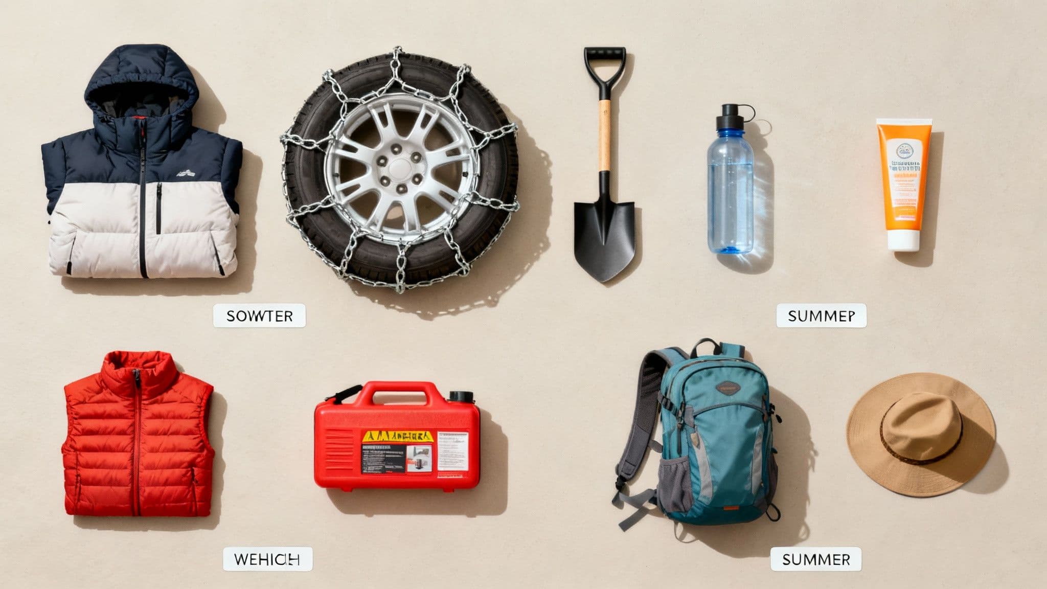
Winter Essentials Checklist
- Vehicle Prep: Ensure you have M+S or 3PMSF tires with good tread. Keep your gas tank at least half full.
- Emergency Kit: Every car should have a shovel, ice scraper, extra blankets, water, and snacks.
- Personal Gear: Dress in non-cotton layers: a moisture-wicking base layer, an insulating mid-layer (fleece), and a waterproof shell.
- For a deeper dive, read our guide to preparing for winter drive weather conditions.
Summer & Fall Essentials Checklist
- Hydration & Sun Protection: Bring more water than you think you need. High elevation and dry air dehydrate you quickly. Sunscreen, sunglasses, and a hat are non-negotiable.
- Rain Gear: Pack a lightweight, waterproof jacket, even if the sky is clear.
- Navigation: Download offline maps or carry a physical map, as cell service is spotty.
- You can explore long-term patterns on annual climate trends on WeatherSpark.com.
Cottonwood Heights Weather FAQ
What does the Traction Law mean if I have a rental car?
Most rental cars are not equipped with the required snow-rated tires (M+S or 3PMSF), and rental agreements typically prohibit the use of chains. If the Traction Law is in effect, your safest and best option is to take the UTA Ski Bus, which is fully equipped for winter road conditions.
When is avalanche risk highest?
Avalanche danger spikes during and immediately after a major snowstorm, especially one with high winds. Sudden warm-ups in the spring also create very dangerous wet slab conditions. However, dangerous conditions can exist anytime. Always check the daily report from the Utah Avalanche Center before heading into the backcountry or parking near steep, snow-loaded slopes. For more local info, check our guides to Little Cottonwood Canyon and Big Cottonwood Canyon.