Snowbird Utah Conditions: Your Guide to Snow, Lifts & Roads
Get the latest Snowbird Utah conditions. This guide covers how to read the snow report, check live road status, understand avalanche forecasts, and get real-time lift updates.
Planning a trip to Snowbird? This guide provides your complete pre-flight checklist for current Snowbird Utah conditions. We’ll show you how to find real-time data on snowfall, road status in Little Cottonwood Canyon, lift operations, and avalanche danger so you can spend less time guessing and more time skiing.
What are the current conditions at Snowbird?
Getting a clear, up-to-the-minute picture is the first step to a great day on the mountain. Whether you're chasing first chair on a powder day or just cruising a bluebird afternoon, knowing what's happening right now is key. It’s often the difference between a smooth ride up the canyon and getting stuck in that infamous "red snake" of brake lights.
This snapshot pulls all the most critical live info into one place, so you can make quick, smart calls. We're focused on the essentials:
- Current Weather and Snowfall: How much fresh stuff fell in the last 24 hours? What are the temps at the summit and the base?
- Road and Traffic Status: Is State Route 210 open? Are traction laws in effect?
- Avalanche Danger: What's the latest risk level from the Utah Avalanche Center?
- Mountain Operations: Are key lifts like the Tram on a wind hold?
To make it even easier, here's a quick-reference table summarizing where to find the live data for these critical metrics.
Snowbird Live Conditions Snapshot
A summary of the most critical real-time data points for planning your trip to Snowbird.
| Condition Metric | Where to Find Live Data |
|---|---|
| 24-Hour Snowfall | Snowbird Snow & Weather Report |
| Road Status (SR-210) | UDOT Traffic Cameras & Alerts |
| Avalanche Forecast | Utah Avalanche Center |
| Lift & Terrain Status | Snowbird Lifts & Terrain Status |
This table gives you a direct line to the most current information, taking the guesswork out of your planning.
Why Snowfall Data Matters
Snowbird's reputation is built on legendary powder, and that snowfall directly shapes your entire experience. The resort historically averages around 427 inches a year, but some seasons just go completely off the charts.
Take the historic 2022-2023 season. Snowbird got hammered with over 800 inches, absolutely shattering its previous all-time high of 783 inches. It created some of the deepest, most incredible conditions anyone had ever seen. You can see just how insane it was in this video celebrating the historic snowfall.
A quick check of these metrics can be the difference between carving fresh tracks and sitting in your car. It’s about skiing smarter, not just harder.
By pulling these details together before you go, you get an immediate, actionable game plan. You'll know if you need to throw on extra layers, make sure your snow tires are on, or maybe just call an audible and hop on the UTA Ski Bus to skip the canyon congestion altogether. This simple habit ensures you spend way more time skiing and a lot less time guessing.
How do I read the Snowbird snow report?
A snow report tells a story, and it's about a lot more than just a single depth number. When you learn to decode that story, you go from being a casual skier to someone who truly understands the Snowbird Utah conditions. This is the secret to knowing what the mountain will feel like before you even click into your bindings.
The most basic numbers you see—new snow and base depth—are just the starting point. Think of it like this: the base depth is your savings account, built up all season long. A healthy base, say 100+ inches, means fantastic coverage over rocks and other hazards. New snow is your daily paycheck—the fresh, exciting stuff everyone is chasing.
Beyond the Numbers: New Snow vs. Base Depth
But here's the thing: not all new snow is created equal. A foot of light, fluffy "blower" powder from a cold storm skis completely differently than a foot of heavy, wet "Sierra cement." This is where a slightly more advanced metric, Snow Water Equivalent (SWE), comes into play. A higher SWE means the snow has more moisture, making it heavier. That’s great for building base, but it’ll feel denser and maybe a bit slower under your skis.
Local Tip: The real art is putting these numbers together. A report showing 8 inches of new, low-SWE powder on top of a solid 120-inch base? That’s the recipe for an unforgettable day. It tells you there's a soft, forgiving surface with zero fear of hitting whatever is underneath.
When does Snowbird get the most snow?
Looking at past data gives you a huge advantage, especially when planning a trip. Snowfall at Snowbird isn't a flat line through the winter; it comes in waves and follows predictable patterns that can help you target the deepest days. The resort’s peak snowfall, for instance, almost always hits in mid-winter.
Recorded monthly averages for Little Cottonwood Canyon tell a clear story. The winter starts strong, builds to a peak in the middle, and then tapers off as spring rolls in. Typically, snowfall ramps up from December to a peak in January, stays deep through February, and then starts to ease up in March. You can dig into this data yourself by checking out Alta's monthly snowfall records, which offers incredible insight into the patterns for the whole canyon.
This historical context lets you plan your trips when the odds of scoring an epic powder day are highest.
Putting It All Together for the Perfect Day
So, how do you use all this to your advantage on any given morning?
- Check the 24-hour total: This tells you what fell overnight. Anything over 6 inches is usually a great powder day.
- Look at the base depth: A deep base lets you ski more aggressively and confidently explore off-piste terrain.
- Note the storm cycle: Did the new snow fall over 48 hours, or was it a quick 6-hour blast? Longer, slower storms often produce more settled and stable snow.
By piecing these elements together, you can read the story the mountain is telling you. For a complete picture, our detailed guide on the snow report for Snowbird Utah breaks down even more specifics. Mastering these details ensures you’re always ready for the real conditions you'll find on the slopes.
How do I check the road to Snowbird?
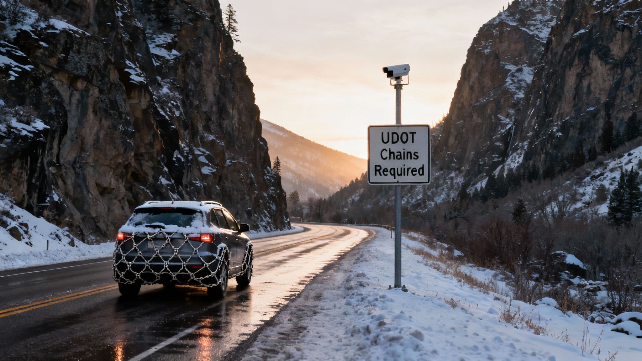
Getting to Snowbird means conquering Little Cottonwood Canyon, a drive that’s as beautiful as it is challenging. This section is your playbook for mastering State Route 210, so you can spend your day skiing fresh powder, not staring at brake lights. We'll break down how to read Utah Department of Transportation (UDOT) alerts, understand the traction laws, and get ahead of the infamous "red snake."
The journey up SR-210 is an adventure in itself, especially when a storm rolls in. The road’s steep grades and tight switchbacks demand respect and, more importantly, preparation. Knowing the rules before you head out is non-negotiable—not just for your own safety, but for keeping the canyon moving for everyone else.
Decoding UDOT Road Alerts
When you check the Snowbird Utah conditions, you’re going to see alerts from UDOT. It's critical to know what they actually mean before you're stuck at a checkpoint.
- Chains or 4WD/AWD Required: This is the most common winter restriction. It means your vehicle must have either four-wheel drive (or all-wheel drive) paired with proper snow tires (look for the M+S or 3-peak mountain snowflake symbol). If you’re in a two-wheel drive vehicle, you need chains installed. Patrol is strict about this; they will turn you around if you don't have the right equipment.
- Interlodge: This is a much more serious situation. Interlodge is usually triggered by extreme avalanche danger or when crews are doing avalanche mitigation work. When it's active, everyone in the town of Alta and at Snowbird is required by law to stay indoors. All travel is prohibited until authorities give the all-clear. It’s rare, but it’s a critical safety protocol.
Local Tip: Staying informed is your best defense against getting stuck. Always check the UDOT Traffic app or their website right before you leave. That one simple step can save you hours of frustration and keep you out of potentially dangerous driving conditions.
Beating the Infamous Red Snake
On a powder morning, the "red snake"—that long, glowing line of taillights snaking up the canyon—is practically a landmark. To avoid it, timing is everything.
Locals know the only real strategy is to go exceptionally early, aiming to be at the mouth of the canyon well before the lifts even start spinning. Your other option is to wait until the initial chaos dies down, usually after 10 a.m.
An even better option? Skip driving altogether. The UTA Ski Bus is a stress-free and cheap way to get up to the resort. With several Park & Ride lots along the Wasatch Front, you can just sit back, save on gas, and completely avoid the nightmare of finding a parking spot—which often requires a reservation on busy days anyway. For more deep-dive strategies, our complete guide to the Little Cottonwood Canyon road has all the details on travel times and tips.
How do I find the avalanche forecast?
The legendary steep terrain at Snowbird is a massive part of its allure, but that same terrain demands a healthy respect for mountain safety. Before you even dream of dropping into an expert-only zone like Gad Chutes or the Cirque, checking the daily avalanche forecast is non-negotiable. It's the first step to making smart calls that keep you and everyone around you safe.
The absolute gold standard for this information is the Utah Avalanche Center (UAC). They issue a daily forecast that breaks down the risk across the Wasatch. Think of their five-level danger scale less like a simple warning and more like a weather report for the snowpack itself. It’s telling you the story of what’s happening in the hidden layers beneath your skis.
How to Read the Danger Scale
The UAC uses a color-coded, five-tier system to communicate the day's risk. Getting a feel for what each level actually means on the ground is critical for interpreting the Snowbird Utah conditions.
The North American Avalanche Danger Scale provides a framework for understanding avalanche risk. Here’s a quick breakdown of what each level means for your day on the mountain.
| Danger Level | Travel Advice | Likelihood of Avalanches |
|---|---|---|
| Low (Green) | Generally safe, but always watch for isolated unstable snow. | Natural avalanches are very unlikely. Human-triggered avalanches are unlikely. |
| Moderate (Yellow) | Be cautious on specific terrain features. Most accidents happen here. | Natural avalanches are unlikely. Human-triggered avalanches are possible. |
| Considerable (Orange) | Avoid steeper terrain and avalanche-prone slopes. Danger is elevated. | Natural avalanches are possible. Human-triggered avalanches are likely. |
| High (Red) | Travel in or near avalanche terrain is not recommended. Stick to low-angle terrain. | Natural and human-triggered avalanches are very likely. |
| Extreme (Black) | Avoid all avalanche terrain. This is extremely rare. | Widespread, destructive avalanches are certain. |
This scale isn't just for backcountry skiers; it gives every rider at Snowbird valuable context about the snowpack's stability, even within resort boundaries.
The UAC’s homepage gives you a fantastic visual summary of the day's forecast at a glance.

This snapshot instantly shows you which elevations and aspects are holding the most risk, helping you plan your runs before you even get on the tram.
Snowbird Ski Patrol and In-Bounds Safety
Within the resort boundaries, Snowbird’s highly skilled Ski Patrol works around the clock to mitigate avalanche risk. Their day starts long before the first Tram cabin heads up, using explosives and other techniques to test and stabilize the snowpack on steep terrain.
"We need to get patrollers up there to evaluate the conditions. Sometimes by helicopter and often conduct avalanche mitigation with hand-charge explosives and projectiles." - Eric Murakami, Director of Snow Safety at Snowbird
This intensive work is exactly why skiing in-bounds is dramatically safer than venturing into the backcountry. The ropes and "Closed" signs you see are not suggestions—they're direct orders. They mean the terrain beyond has not been controlled by patrol and is unsafe.
Respecting these boundaries is the single most important safety rule at the resort. While the daily UAC forecast provides crucial context for the day, always trust and obey the on-mountain closures. The patrol has the most specific, up-to-the-minute intel on what’s safe to ski inside the ropes.
How do I check lift and terrain status?
A perfect powder day isn't just about how much snow fell overnight. It's about knowing which lifts are spinning and what terrain is actually open. Getting a handle on Snowbird's live operational status is your key to unlocking the mountain, helping you score fresh tracks while everyone else is still huddled at the base of a closed lift.
Before you even pull on your boots, a quick check of the Snowbird Utah conditions on their official channels can completely reshape your day. This is especially true after a big storm when ski patrol is out doing avalanche mitigation, which often means staggered or delayed openings for the best terrain.
Why Lifts Go on Hold
Seeing your favorite chair marked "on hold" is frustrating, but there are always critical safety reasons behind it. Understanding why helps you predict how the day might unfold.
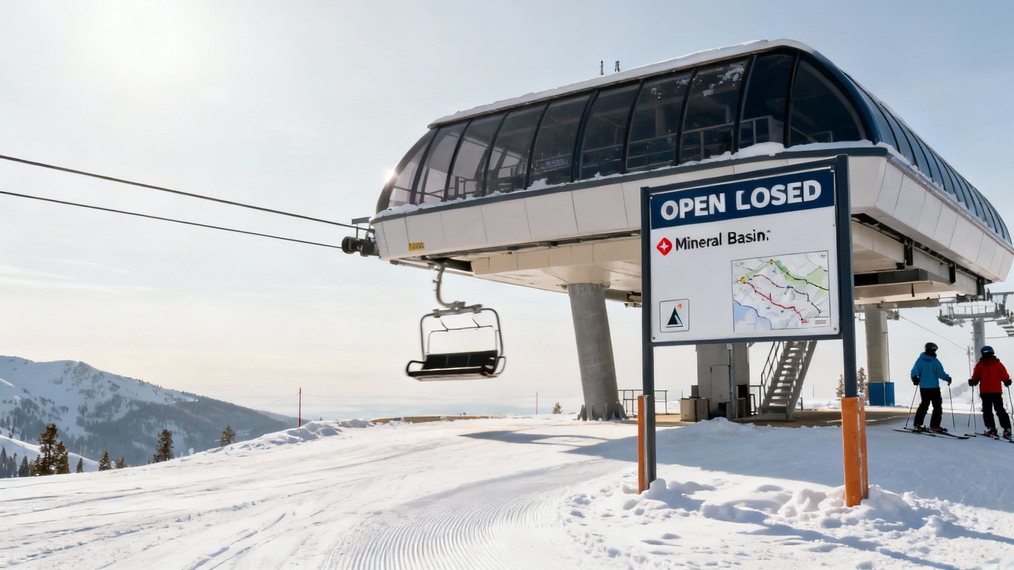
- Wind Hold: This is the usual suspect at a high-alpine resort like Snowbird. Fierce winds, especially along the ridgelines, make it downright dangerous to run lifts like the Aerial Tram or Mineral Basin Express.
- Mechanical Issue: It happens. While not as common, mechanical glitches can put a lift on pause. These delays can be short or long, depending on what needs fixing.
- Avalanche Control: After a big dump, ski patrol needs time to make the slopes safe before opening lifts that access steep terrain. This is the classic reason Mineral Basin might have a delayed opening after a storm.
Local Tip: The best way to stay ahead of the game is to use Snowbird's official channels. Their Mountain Report and mobile app are your direct line to real-time operational data, taking all the guesswork out of your morning.
Turning Information into a Strategy
This is where smart skiers separate themselves from the crowd. Use the lift status report to build a game plan. If the Tram is on a wind hold first thing, don't waste time waiting at the base—head over to the Gad Valley lifts and start lapping there instead.
The real magic happens when a lift that's been on hold finally opens mid-morning, unlocking huge fields of untracked snow. By keeping an eye on the app and positioning yourself nearby, you can be one of the first to drop in. This simple habit turns you from a reactive skier into a proactive powder hound.
How do Snowbird conditions compare to Alta?
Snowbird and Alta might share a ridgeline in Little Cottonwood Canyon, but they serve up two surprisingly different experiences on the snow. They're neighbors, but tiny shifts in geography and long-held resort policies create real differences in how the snow skis and how long it stays good.
Knowing these details helps you pick the right spot for the day or, even better, get the most out of an Alta-Bird pass.
The most obvious difference is simple geography. Alta's upper bowls are tilted slightly more to the north than Snowbird's, which means they get less direct sun. It sounds minor, but that little bit of shade is huge for preserving the light, dry "blower" powder that makes Little Cottonwood famous. It keeps the snow chalky and cold for days after a storm, while some of Snowbird’s more exposed terrain can get sun-baked a bit faster on a warm, bluebird day.
How Resort Policies Impact Snow
The other big piece of the puzzle is Alta's classic skiers-only policy. No snowboards allowed. This changes how the mountain gets tracked out. You'll find fewer wide, scraped-off traverses and more untracked stashes between the main lines. It gives the snow a completely different texture.
This policy also shapes the whole vibe of the place, giving Alta a more traditional, purist feel that a lot of skiers are looking for.
To get a complete picture of what makes its snow so unique, check out our deep dive in the Alta snow report guide.
Making the Most of the Alta-Bird Pass
Back in 2002, the two resorts started offering a combined pass, opening up a massive 4,700 acres of interconnected terrain for skiers. This move created one of the biggest ski areas in North America, and you can read up on the historic partnership that links the two resorts if you're curious.
Local Tip: The interconnect gates are your key to this massive playground. You’ll find them at the top of Snowbird’s Mineral Basin and Alta’s Sugarloaf lift, letting skiers cross back and forth seamlessly.
To get from Snowbird to Alta, just ride the Mineral Basin Express lift and look for the signs pointing to the gate. To come back from Alta, head toward the top of the Sugarloaf lift. Just make sure your Alta-Bird pass is ready to be scanned at the gate. And remember, this is a one-way street for snowboarders—they can't cross into Alta.
Using the gates opens up a world of possibilities, letting you chase the sun, shade, and best snow all day long.
Frequently Asked Questions
To help you get the most out of your trip, here are a few quick answers to the questions we hear all the time. Think of this as the local's cheat sheet for everything from dodging traffic to finding out if the gnarly terrain is open.
What time should I leave to beat traffic to Snowbird?
On a powder day, it's simple: you need to be at the mouth of Little Cottonwood Canyon by 7:00 AM. Any later and you risk getting stuck in the infamous "red snake" of brake lights. If that’s just too early, your next best window is after 10:00 AM, once that initial wave of powder-hungry skiers has dissipated.
How can I find out if Pipeline Couloir is open?
Pipeline's status is intentionally not published online. The only way to know for sure if Pipeline is open is to physically go to the Snowbird Ski Patrol office at The Summit on Hidden Peak and ask them in person. They will require you to have a partner, proper avalanche safety gear (beacon, shovel, probe), and sign a waiver.
Is the UTA Ski Bus a good option for Snowbird?
It's a great one. The UTA Ski Bus is the smartest way to get up the canyon. It eliminates the stress of snowy roads, the need for a 4WD vehicle, and the parking reservation hassle. A one-way ride is only $5, and many season passes include free bus fare.
For the most reliable, real-time road and traffic updates for your trip up the canyon, check out Wasatch Roads. We consolidate live data to make your travel planning seamless. Visit us at https://wasatchroads.com to get the latest conditions before you go.