Snow Report Snowbird: Your Guide to Powder, Weather & Travel
Learn how to read the Snowbird snow report like a local. This guide covers how to analyze snow totals, weather, and road conditions for a perfect powder day.
Planning a trip to Snowbird? The key to scoring the best powder and navigating Little Cottonwood Canyon safely is understanding the Snowbird snow report. This guide shows you how to read snow totals, weather data, and live road conditions to make smart decisions, avoid traffic, and maximize your time on the mountain.
What is a Snowbird Snow Report and Why is it Essential?
A Snowbird snow report is more than just a snowfall number; it's a vital tool for safety, planning, and getting the most out of your day. Snowbird is legendary for its steep lines and massive snowfall, but conditions in Little Cottonwood Canyon can change in an instant. The report provides a complete picture of new snow, base depth, weather, and lift status before you even leave home.
Knowing how to interpret the report helps you answer critical questions:
- What will the snow feel like? A big number is great, but was it accompanied by high winds? This can turn fluffy powder into firm wind-buff.
- What terrain will be open? A deep base is required for expert zones like the Cirque to open. The report’s base depth tells you if that terrain is even an option.
- How should I travel? A huge storm might bring amazing snow, but it could also mean the canyon road is closed or requires 4WD/chains.
A savvy skier uses the snow report Snowbird to connect the dots between snowfall, weather, and logistics. It’s the difference between a frustrating day stuck in traffic and a legendary day scoring untracked lines.
How to Read Snow Totals and Base Depth
When you pull up a Snowbird snow report, your eyes jump to new snow and total base depth. While fresh snow gets all the glory, a healthy base is what really dictates how much of the mountain is open and skiable. To plan a great day, you must understand the interplay between both.
What the Numbers Mean for Your Day
It's easy to focus on a big snowfall number, but not all powder days are created equal. The timing and context of the snowfall matter just as much as the total. Here’s what to look for in our live data:
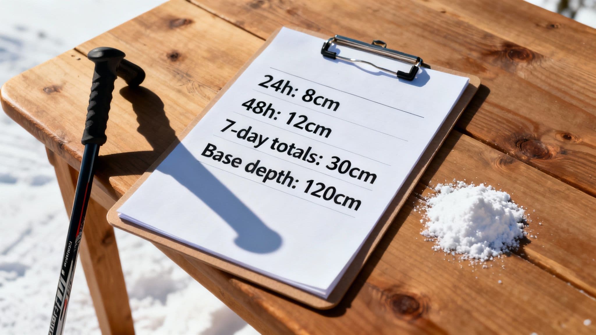
- 24-Hour Total: This is your headline number. Anything over 6 inches is a great sign for fresh tracks, but you have to ask: what did it fall on? If it was firm and icy yesterday, you might just have "dust on crust."
- 48-Hour Total: This gives you a better feel for a storm's real impact. A solid 48-hour number often means the new snow has had time to bond with the old layers, creating that silky, supportive surface we all dream of.
- Base Depth: This is the most underrated metric. A deep, consolidated base is what unlocks Snowbird’s legendary expert terrain. Without that solid foundation, obstacles like rocks and stumps stay hidden. This is why iconic zones can stay closed even after a decent storm—the base just isn't there yet.
Local's Tip: The secret to a legendary day isn’t just finding new snow; it's finding new snow on top of a deep, supportive base. That's when the entire mountain opens up and the conditions become truly world-class.
Why Snowbird's Base Matters
Snowbird is famous for its massive snowfalls, which can build a base that lasts deep into the spring. The 2022-2023 season was one for the history books, when the resort was hammered with a staggering 839 inches of snow. That kind of accumulation is what makes Snowbird's spring skiing so incredible—the coverage holds up across the entire mountain. To see how the current season is stacking up, check how Snowbird's snowpack is tracked.
Learning to read a snow report is a universal skill. You can use the same logic when you check out the Alta ski resort snow report, our neighbor just up the road.
How Weather and Seasonal Trends Affect Your Trip
The secret to consistently scoring great days at Snowbird is learning to read the bigger picture—the immediate weather forecast and seasonal trends. It’s what separates a good day from an unforgettable one.
What to Check in the Forecast
Beyond the snow totals, three key weather elements from the Snowbird snow report will make or break your day:
- Wind: High winds can shut down the Aerial Tram and other exposed lifts in a heartbeat. They can also create incredible wind-buffed powder on one aspect while scouring another down to ice.
- Temperature: Cold, consistent temps keep the powder light and dry. A sudden warm-up, however, can turn that fluff into heavy "mashed potatoes." A freeze after a thaw creates a rock-solid, unforgiving surface.
- Visibility: Navigating Snowbird’s legendary terrain is tough in "flat light." On a foggy day, stick to runs with trees, like those off the Gadzoom lift, which provide the contrast you need to see the terrain.
When to Plan Your Visit Based on Snowfall Patterns
If you're chasing that quintessential, snorkel-deep powder experience, January and February are your prime months. This is when the storm cycles are most consistent and the temperatures stay cold. The historical data from sources like Snowbird's monthly snowfall patterns on snow-forecast.com shows these months receive the most frequent, significant storms.
- Early Season (Nov-Dec): The stoke is high, but the base is usually thin. Stick to marked trails and watch out for rocks.
- Late Season (Mar-Apr): This is when the base is typically at its deepest. You’ll get more bluebird days and awesome spring corn snow, but true powder days become less frequent.
For a deeper dive into storm predictions, check out our complete guide to the Wasatch snow forecast.
How to Put the Snow Report into Action
The best strategy starts the night before. I always check the forecast around 9 PM to see what's expected overnight. If the report is calling for 6-10 inches, that’s your cue that Little Cottonwood Canyon traffic will be challenging. This foresight lets you lay out your gear, set an alarm, and decide if you're driving or taking the Utah ski bus service.
A Local's Morning Checklist
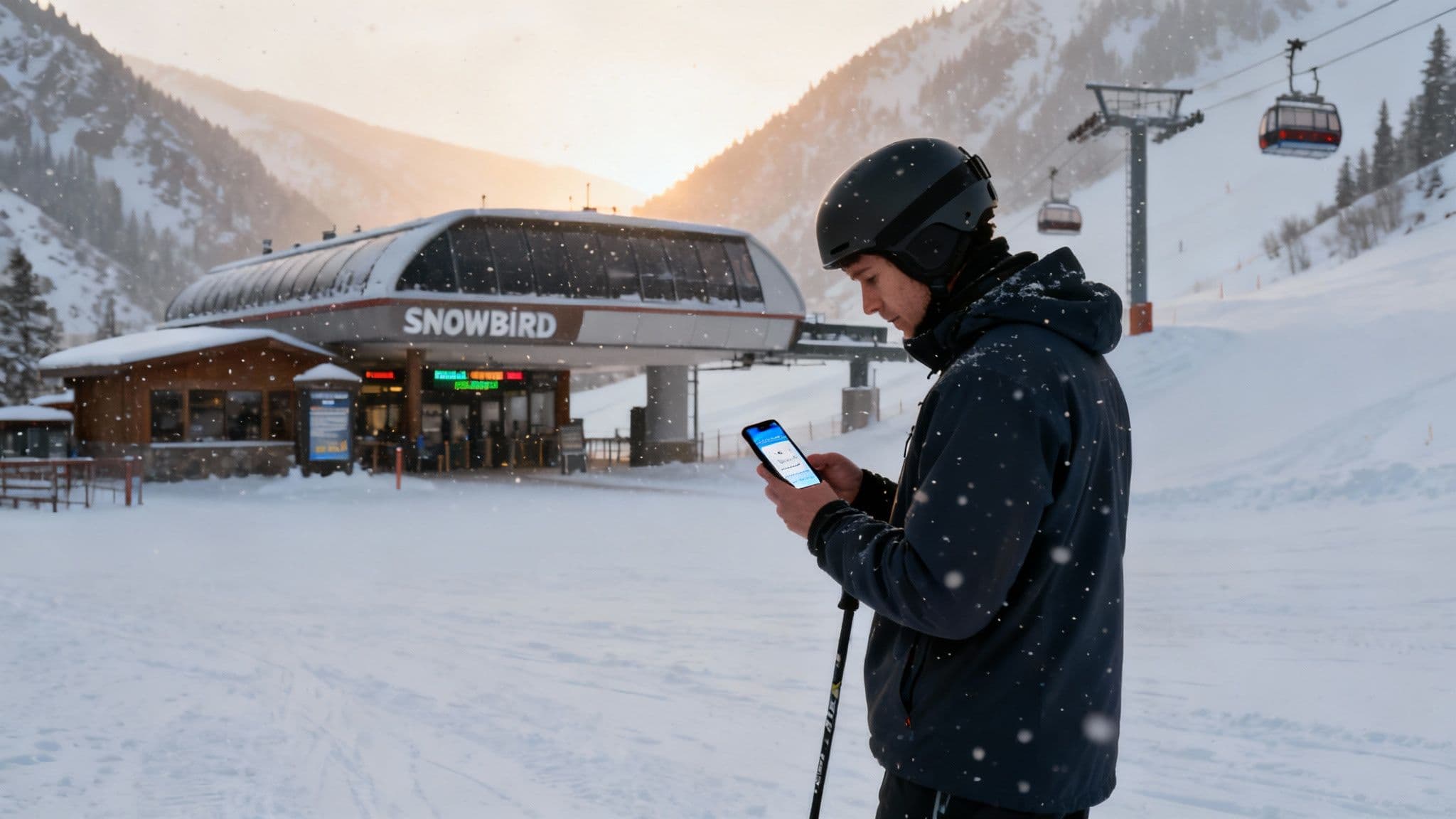
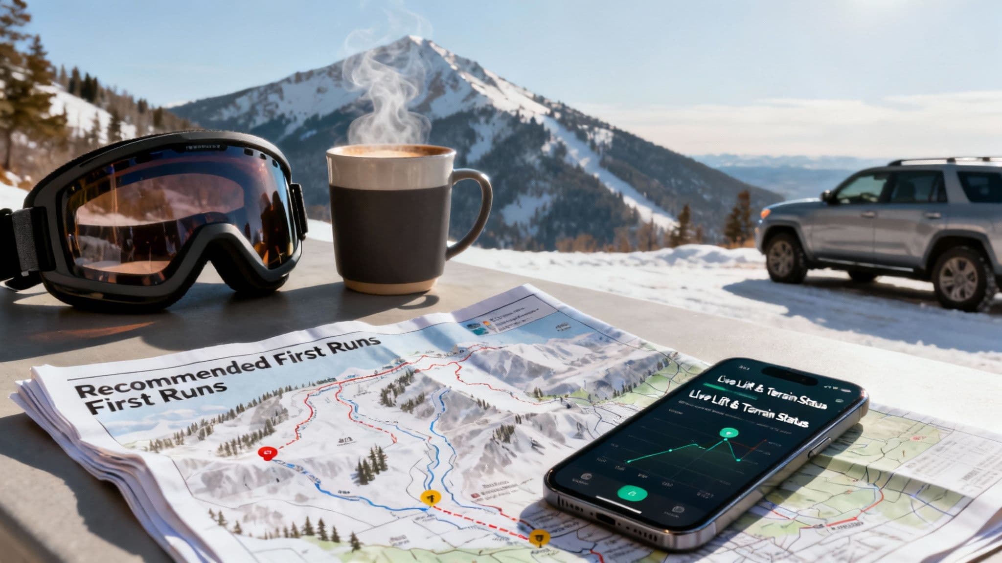
At 6 AM, it’s game time. Pull up our live data feeds to get the full, up-to-the-minute picture. Here’s the mental checklist I run through every powder morning:
- New Snow vs. Road Status: The report shows 12 inches of fresh snow. Incredible! But our live feed for Little Cottonwood Canyon says traction laws are in effect, or the road is closed for avalanche control. This is the most important cross-check; that powder is worthless if you’re stuck at the bottom of the canyon.
- Interlodge Alerts: During a huge storm cycle, the first thing to look for is an "Interlodge" alert. This is a critical safety order that means all outdoor travel is prohibited due to extreme avalanche risk. It will be posted on all official resort and travel sites.
- Lift & Terrain Status: Check which lifts are on wind hold or have a delayed opening. If the Tram is shut down but Gadzoom is spinning, you know to start your day lapping the trees on the lower mountain while you wait for the high-alpine terrain to open up.
Local's Tip: Numbers only tell part of the story. I always cross-reference the report with live mountain cams. This quick visual check tells you what the visibility is really like and how the snow surface is setting up before you even step out the door.
By putting these pieces together, you stop just reading a report and start building a strategy. It means less time sitting in traffic and more time slashing turns in the best snow on the mountain.
Snowbird Snow Report FAQ
What is the best time to check the report? Check it twice: the night before (around 9 PM) to plan for the morning, and again at 6 AM for the official overnight snow totals and the live road status for Little Cottonwood Canyon.
How accurate is the new snow forecast? Modern weather forecasting is sharp for the next 24-48 hours, but Little Cottonwood Canyon’s microclimate is unpredictable. Use the forecast to prepare, but trust the "new snow in the last 24 hours" number as your ground truth.
What does "Interlodge" mean? Interlodge is a critical safety protocol unique to Little Cottonwood Canyon where all outdoor travel is prohibited due to extreme avalanche danger. It is a legal order to stay indoors until lifted and is triggered during the biggest storms to keep everyone safe.
For the most current and comprehensive canyon conditions, trust Wasatch Roads to get you to the powder safely. Check our live data feeds at https://wasatchroads.com.