
I-5 Grapevine (Tejon Pass)
The LA–Central Valley funnel — live status and cameras over 4,144‑foot Tejon Pass, the closure everyone checks first.
From Caltrans’s live chain-control feed — updated now. Confirm the posted level on QuickMap (quickmap.dot.ca.gov) or dial 511 before you commit.
the Grapevine cameras, in drive order
All 9 live California Caltrans cameras along I-5, ordered south to north — read the strip like the drive.

I-5 @ Magic Mtn Truck Scales
facing north

I-5 @ N
facing south

I-5 @ Smokey Bear Rd
facing south

I-5 @ Gorman School Dr
facing south
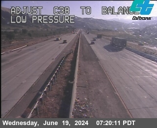
LA-5-AT LEBEC (FRAZIER)
facing south
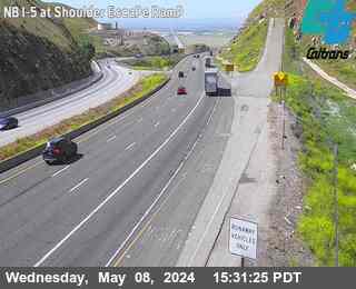
KER-5-AT TRUCK ESCAPE RAMP (SHOULDER)
facing north
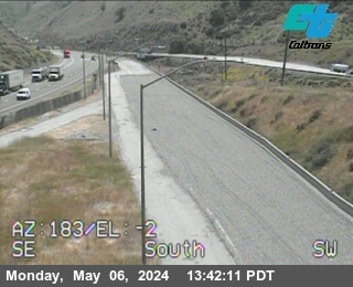
KER-5-AT TRUCK ESCAPE RAMP(MEDIAN)
facing north
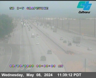
KER-5-AT GRAPEVINE UC
facing south
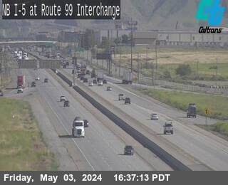
KER-5-AT RTE 99
facing north
Pass weather right now
Caltrans road-weather stations along the corridor — the same sensors the chain-control decisions use.
About the Grapevine
"Is the Grapevine open?" is a Southern California winter ritual for a reason: I‑5 over Tejon Pass (4,144 feet) is the only direct road between Los Angeles and the Central Valley, and when snow, ice, dense fog or a hard wind event shuts it, the alternatives add hours — SR‑58 over Tehachapi to SR‑99, or the long coastal loop on US‑101. Tens of thousands of trucks a day have no good plan B.
The pass closes to snow a few times most winters — usually briefly, sometimes with CHP escorting convoys over the top between waves — but the Grapevine's hazards are year-round: tule fog drifting up from the valley floor, high-wind advisories through Gorman, and brush-fire closures in summer. A camera check answers in seconds what the rumor mill argues about for hours.
The strip below runs south to north — Castaic Junction up through Hungry Valley Road and Frazier Mountain Park Road near Gorman, over the crest at Lebec and Fort Tejon, then down the famous grade to the valley floor at Grapevine. The banner above it reads Caltrans's live chain-control feed for the corridor.
Driving the Grapevine in winter
- Snow at Frazier Park or Gorman while LA is sunny is normal — check the summit cameras before committing to the climb, especially at night when the pass ices.
- When Caltrans and CHP close the Grapevine they often reopen it in escorted pulses; the cameras show whether traffic is actually moving long before the apps catch up.
- If the pass is closed and you must travel, SR‑58 (Tehachapi) to SR‑99 is the standard detour — check its cameras too, since the same storm often hits both.
- Fog is the underrated killer here: the run-up from the valley floor can drop to near-zero visibility on winter mornings with no snow anywhere.
- Official word beats everything — confirm closures and escorts on Caltrans QuickMap (quickmap.dot.ca.gov) or dial 511 before you go.
Explore more
The full camera maps and guides around this corridor.